
Images


April 29, 2021 - Salt Flats in Argentina
 Tweet
Tweet
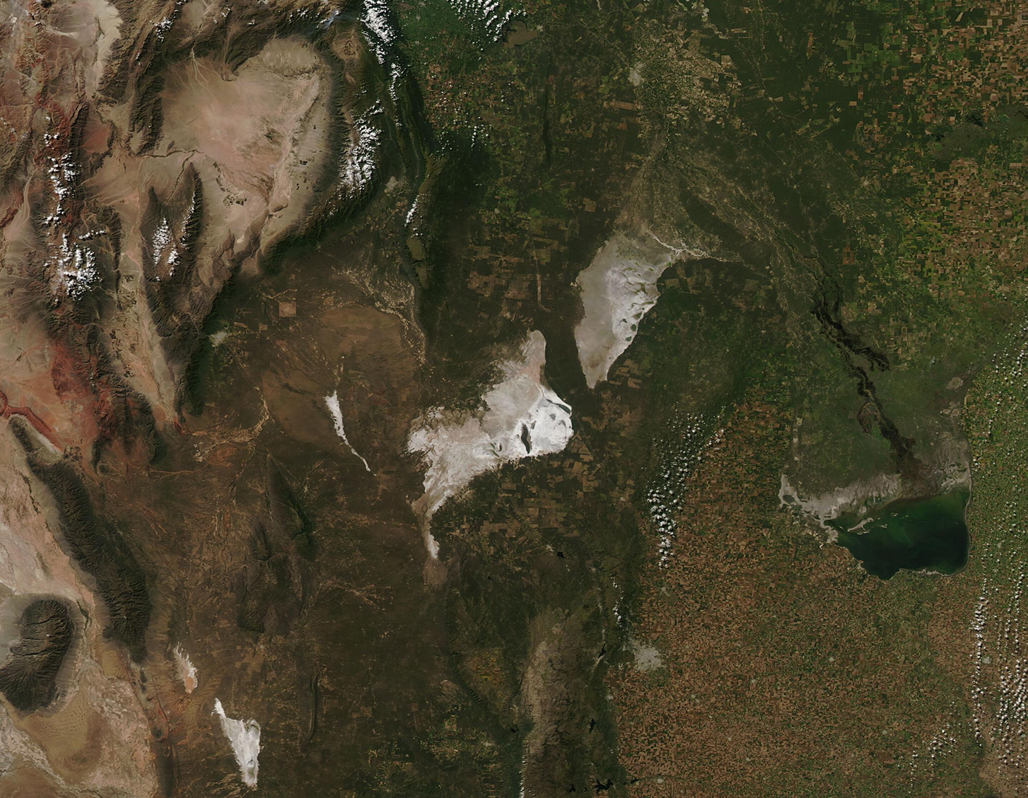
On April 27, 2021, the Moderate Resolution Imaging Spectroradiometer (MODIS) on board NASA’s Aqua satellite acquired a stunning true-color image of central Argentina’s salt flats tucked away amid green scrubby vegetation, agricultural fields, and dry mountains. To the southeast, the Laguna Mar Chiquita is fed by the Dulce River and appears green.
Lago Salinas de Ambargasta sits north of Lago Salinas Grandes with the Pampas Mountains to the west. The two salt-encrusted, shallow lakes sit in a tectonic depression that covers about 18,000 square km (6,950 square miles). In the Quaternary Period, a river to the north carried copious water into these salt flats which, at that time were joined as one large lake, aptly called Laguna Grande. Shifting plate tectonics caused changes in geography, such as raising a ridge up in the middle of Laguna Grande that split the lake into two and shifting the course of the river that fed the lakes. Over time, evaporation caused the lakes to shrink as water became more saline. Eventually little remained other than a thick crust of blindingly white salt. Although Lago Salinas de Ambargasta and Lago Salinas Grandes are typically dry, spring rains sometimes allows water to accumulate in each lake, giving them a tan or, if salt-loving algae is present, a green appearance.
Image Facts
Satellite:
Aqua
Date Acquired: 4/27/2021
Resolutions:
1km (482.4 KB), 500m (1.3 MB), 250m (912.9 KB)
Bands Used: 1,4,3
Image Credit:
MODIS Land Rapid Response Team, NASA GSFC
