
Images


June 2, 2021 - Tropical Storm Choi-wan
 Tweet
Tweet
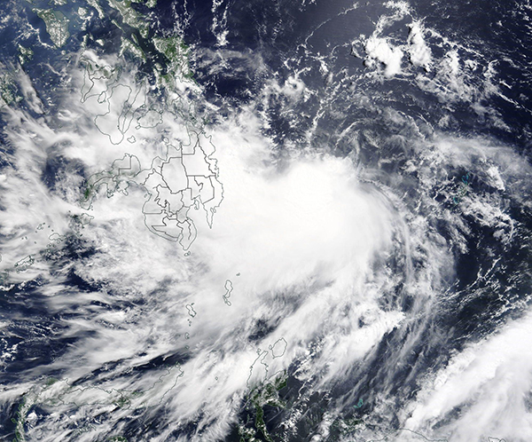
On May 31, 2021, the Moderate Resolution Imaging Spectroradiometer (MODIS) on board NASA’s Terra satellite acquired a true-color image of newly-formed Tropical Storm Choi-Wan (Dante) as it spun north-westward over the Philippine Sea heading towards landfall in the Philippines. At the time the image was acquired, Choi-Wan was an intensifying system with a cloud-filled center of circulation.
According to the Global Disaster Alert and Coordination System (GDACS), Tropical Storm Choi-Wan reached peak strength on May 31 when it sported one-minute maximum sustained winds of 94 km/h (58 mph). It has weakened as it moved into the Philippines, with the Joint Typhoon Warning Center (JTWC) reporting maximum sustained winds of 55.5 km/h (34.5 mph) at 0300 UTC on June 2 (11:00 p.m. EDT June 1). At that time, Tropical Depression Choi-Wan (Dante) was located about 158 miles (254 km) southeast of Manila, Philippines and was moving west-northwestward. Maximum significant wave height was reported at 14 feet (4.3 meters).
On June 1, Tropical Depression Choi-Wan made landfall over the municipality of Sulat, Eastern Samar on the island of Samar in the Eastern Visayas region of the Philippines. About 4.5 hours later, Choi-Wan struck the municipality of Cataingan, Masbate Island, which sits near the center of the Philippine archipelago. By the morning of June 2, the storm was heading towards the island of Romblon. The track of the storm brings it across the island of Luzon, Philippines, close to the city of Manila late on June 2 before moving out of the Philippines.
Image Facts
Satellite:
Terra
Date Acquired: 5/31/2021
Resolutions:
1km (567.8 KB), 500m (1.7 MB), 250m (4.8 MB)
Bands Used: 1,4,3
Image Credit:
MODIS Land Rapid Response Team, NASA GSFC
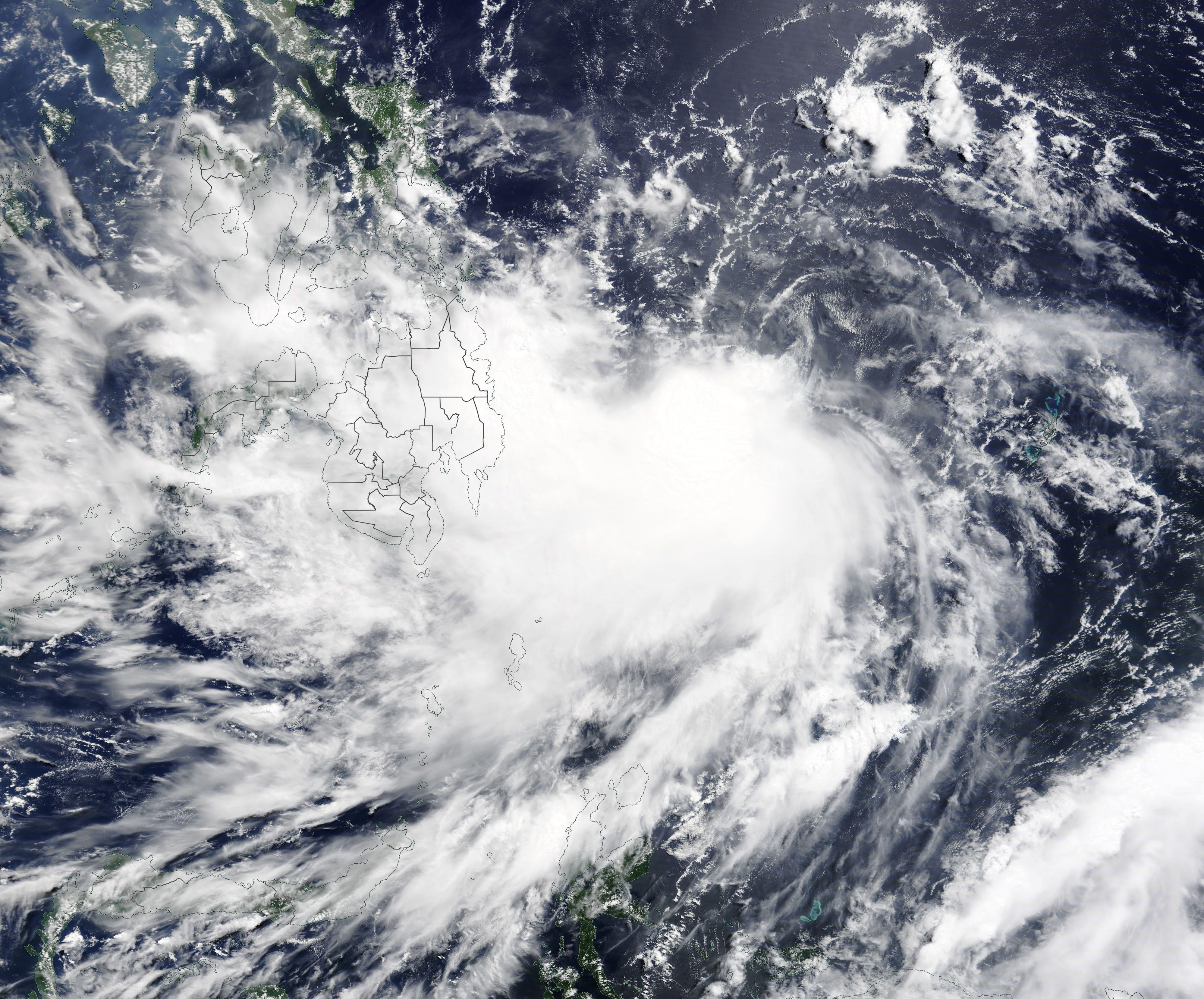
