
Images


June 3, 2021 - Salish Sea
 Tweet
Tweet
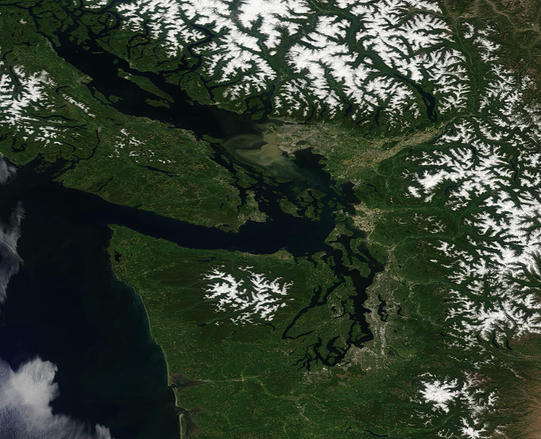
The afternoon of June 1, 2021, was bright and sunny over the Pacific Northwest, allowing the Moderate Resolution Imaging Spectroradiometer (MODIS) on board NASA’s Terra satellite to acquire a gorgeous true-color image of the Salish Sea, Canada (north), and the United States (south).
The blue waters of the southern Salish Sea separate Vancouver Island, Canada from the Olympic Peninsula of the United States. The Salish Sea includes an intricate network of connecting channels and adjoining waterways, including the Strait of Georgia, Strait of Juan de Fuca, and Puget Sound, which primarily lie in southwest British Columbia, Canada. Named for the Salish indigenous people who live along the British Columbia and Washington state (United States) coastline, these waters form an extensive estuary system which is extremely rich in biodiversity and is vital to the welfare of many millions of people who live in the region.
Just above the center of the image, a large brown stain can be seen between Vancouver Island and the coast of the mainland. This is the outflow of the Fraser River, which drains roughly one-quarter the British Columbia as it winds roughly 850 miles to reach Georgia Strait. The brown stain comes from sediment and silt released along with fresh water into the saline Strait from the Fraser. The Fraser River has gained fame as the river with the largest salmon runs in North America.
Image Facts
Satellite:
Terra
Date Acquired: 6/1/2021
Resolutions:
1km (295.4 KB), 500m (773.8 KB), 250m (535.2 KB)
Bands Used: 1,4,3
Image Credit:
MODIS Land Rapid Response Team, NASA GSFC
