
Images


June 7, 2021 - Flooding from Yaas in India
 Tweet
Tweet
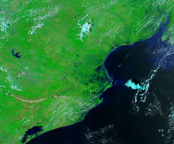
On May 26, 2021, Very Severe Cyclonic Storm Yaas made landfall over the eastern India state of Odisha, bringing roaring winds, torrential rain, and strong storm surge to coastal regions. Sustained winds at landfall were estimated at 130-140 km/h (81-87 mph), with gusts reaching 155 km/h (96 mph). Storm surge in some coastal areas reached about 3 meters (9.8 feet).
As Yaas moved inland, the storm’s windspeed dropped quickly but the soaking rains were unrelenting, triggering heavy flooding across Odisha, West Bengal, and Jharkhand. On May 27, local news outlets reported that more than 600 roads had been damaged in Odisha, with access to 128 villages cut off due to road damage. On that same day, the Global Disaster Alert and Coordination System (GDACS) reported that at least six people had died in India due to the storm and that 22,000 houses had been damaged in Odisha and West Bengal. They also stated that 15,000 people were displaced in 200 villages in Bangladesh as their homes, shops and farms suffered flooding.
On June 3, 2021, the Moderate Resolution Imaging Spectroradiometer (MODIS) on board NASA’s Aqua satellite acquired a false-color image that highlighted the massive and lingering flooding across portions of eastern India. This type of false-color image, using bands 7,2, and 1 on the MODIS instrument (visible and infrared light), shows open land in shades of tan, vegetation as bright green, and water as deep blue. This makes it easy to see the widespread flooding that spreads inland many miles along much of the coastline of the state of Odisha.
Even more information can be gathered from comparing the area before and after the flooding. Thanks to the NASA Worldview app, the image acquired on June 3 can be compared to an image of the same area acquired by Aqua MODIS on May 3, 2021. This was before Very Severe Cyclonic Storm Yaas struck the area. To view the comparison, click here.
Image Facts
Satellite:
Aqua
Date Acquired: 6/3/2021
Resolutions:
1km (208.3 KB), 500m (471.4 KB), 250m (266.5 KB)
Bands Used: 7,2,1
Image Credit:
MODIS Land Rapid Response Team, NASA GSFC
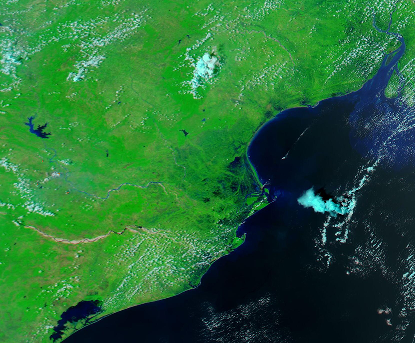
