
Images


June 16, 2021 - Tropical Storm Bill
 Tweet
Tweet
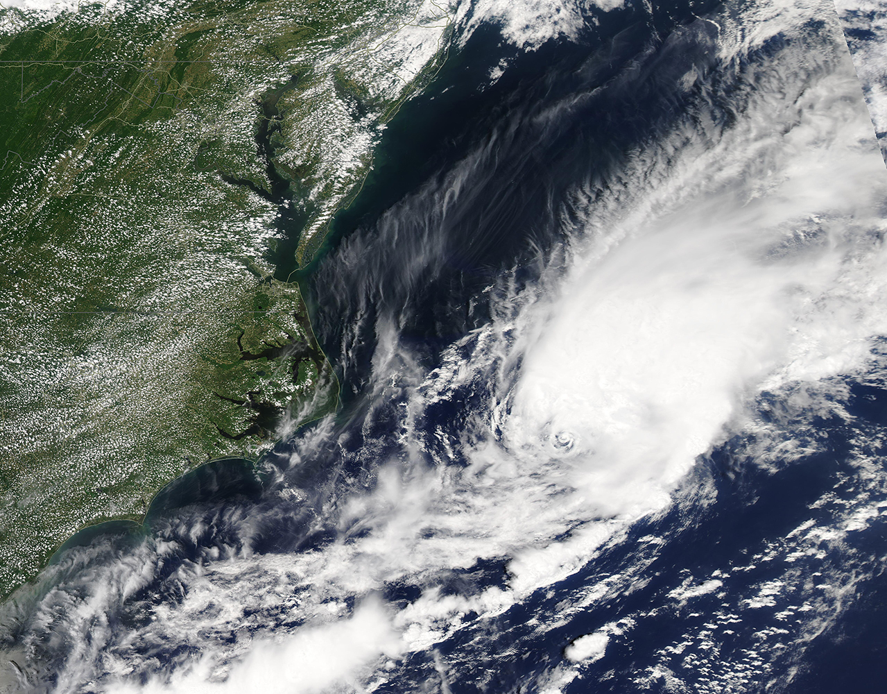
A depression sitting off the coast of North Carolina strengthened on June 14 to form the second named tropical storm of the 2021 Atlantic hurricane season. The Moderate Resolution Imaging Spectroradiometer (MODIS) on board NASA’s Aqua satellite acquired a true-color image of the nascent Tropical Storm Bill on that same day. When the image was acquired, the system had a distinct center of circulation with convection and banding features.
According to the National Hurricane Center (NHC), Tropical Storm Bill formed at 11:00 p.m. EDT (0300 UTC) on June 14 about 335 miles (540 km) east-northeast of Cape Hatteras, North Carolina. At that time, the system’s maximum sustained winds were 45 mph (75 km/h) and it was moving northeast at 23 mph (37 km). This movement has taken it away from land and out into the Atlantic Ocean.
At 11:00 p.m. EDT (0300) on June 15, the NHC issued its last advisory of Bill, as the system had become extra-tropical. At that time, Bill sported maximum sustained winds of 50 mph (85 km/h) and continued to move quickly to the northeast. It was located about 335 miles (540 km) of Halifax, Nova Scotia and 290 miles (470 km) southwest of Cape Race, Newfoundland. No hazards to land are expected.
Image Facts
Satellite:
Aqua
Date Acquired: 6/14/2021
Resolutions:
1km (1.3 MB), 500m (3.4 MB), 250m (2.6 MB)
Bands Used: 1,4,3
Image Credit:
MODIS Land Rapid Response Team, NASA GSFC
