
Images


October 11, 2021 - Dust in the Taklimakan Desert
 Tweet
Tweet
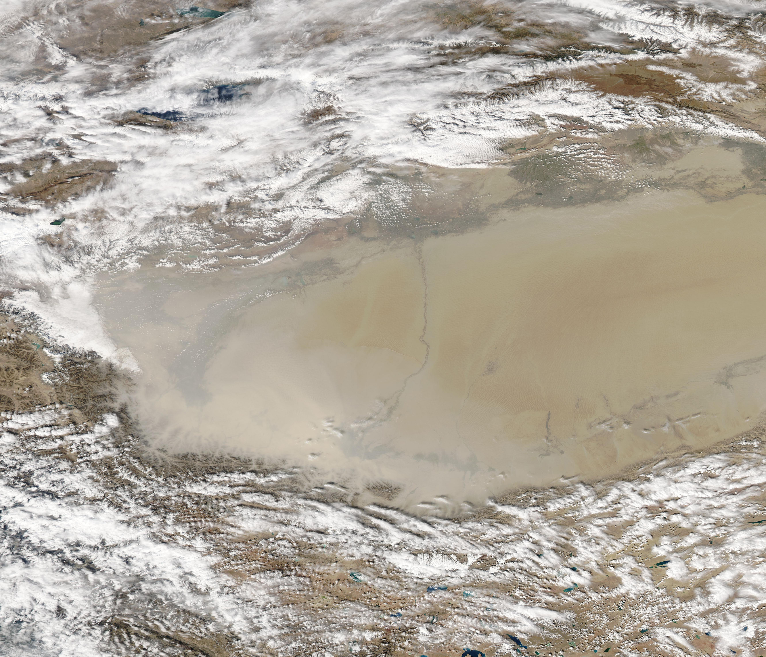
On October 5, 2021, dust stretched more than 790 miles (1,273 km) to cover the entire Taklimakan Desert. The camel-colored dust was thickest in the west, where it was dense enough to completely obscure the satellite sensor’s view of the desert floor. The Moderate Resolution Imaging Spectroradiometer (MODIS) on NASA’s Aqua satellite acquired a true-color image of the scene on that same day.
The Taklimakan Desert sits in the Tarim Basin between the Tien Shan Mountains in the north, and Kunlun Mountains in the south. The Taklimakan is the largest desert in China, and the largest shifting-sand desert in the world, providing ample material for dust storms. Because the desert lacks drainage, it has collected large quantities of salt left behind by evaporating water.
Image Facts
Satellite:
Aqua
Date Acquired: 10/5/2021
Resolutions:
1km (1.3 MB), 500m (3.6 MB), 250m (2.5 MB)
Bands Used: 1,4,3
Image Credit:
MODIS Land Rapid Response Team, NASA GSFC
