
Images


October 27, 2021 - Hurricane Rick
 Tweet
Tweet
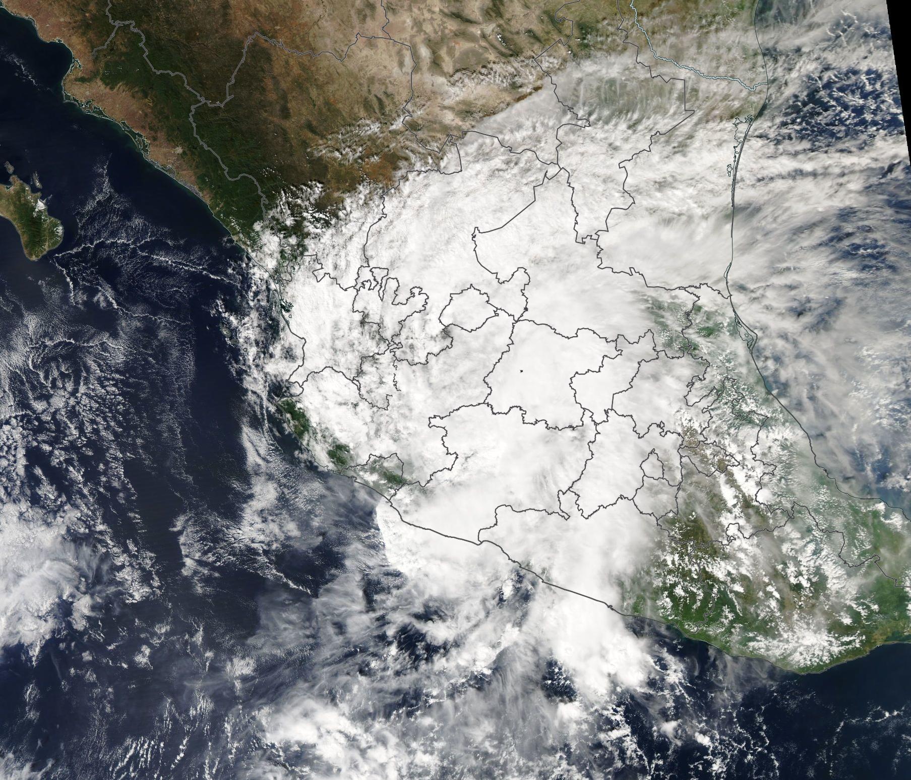
The eighth hurricane of the 2021 Pacific Hurricane season formed over the East Pacific Ocean on October 22 and headed towards southern Mexico. On October 25, Hurricane Rick made landfall about 15 miles (25 km) east of Lázaro Cárdenas, an important port city in the state of Michoacán. At the time Rick struck Mexico, it was carrying maximum sustained winds of 105 mph (165 km/h), placing at a Category 2 storm on the Saffir-Simpson Hurricane Wind Scale.
Once over land, interaction with the rugged mountainous terrain caused Hurricane Rick to weaken quickly and dissipate to the northeast of the landfall site. According to ReliefWeb, Rick and its remnants brought heavy rain with thunderstorms and strong winds of parts of Michoacán, Guerrero, Jalisco, Colima, Guanajuato, Zacatecas, Aguascalientes, San Luis Potosí, Nayarit and Mexico States. More than 50 houses were reported damaged in the Municipality of Tecpan de Galeana as of October 26, with 42 families evacuated. Power outages have been widespread along the coastal regions of Guerrero State.
The Moderate Resolution Imaging Spectroradiometer (MODIS) on board NASA’s Aqua satellite acquired a true-color image of a weakened Hurricane Rick on October 25. The weakly-defined center of the system had moved well inland, and Rick had become asymmetric, indicating a weaking storm.
Image Facts
Satellite:
Aqua
Date Acquired: 10/25/2021
Resolutions:
1km (542.8 KB), 500m (1.8 MB), 250m (5.3 MB)
Bands Used: 1,4,3
Image Credit:
MODIS Land Rapid Response Team, NASA GSFC
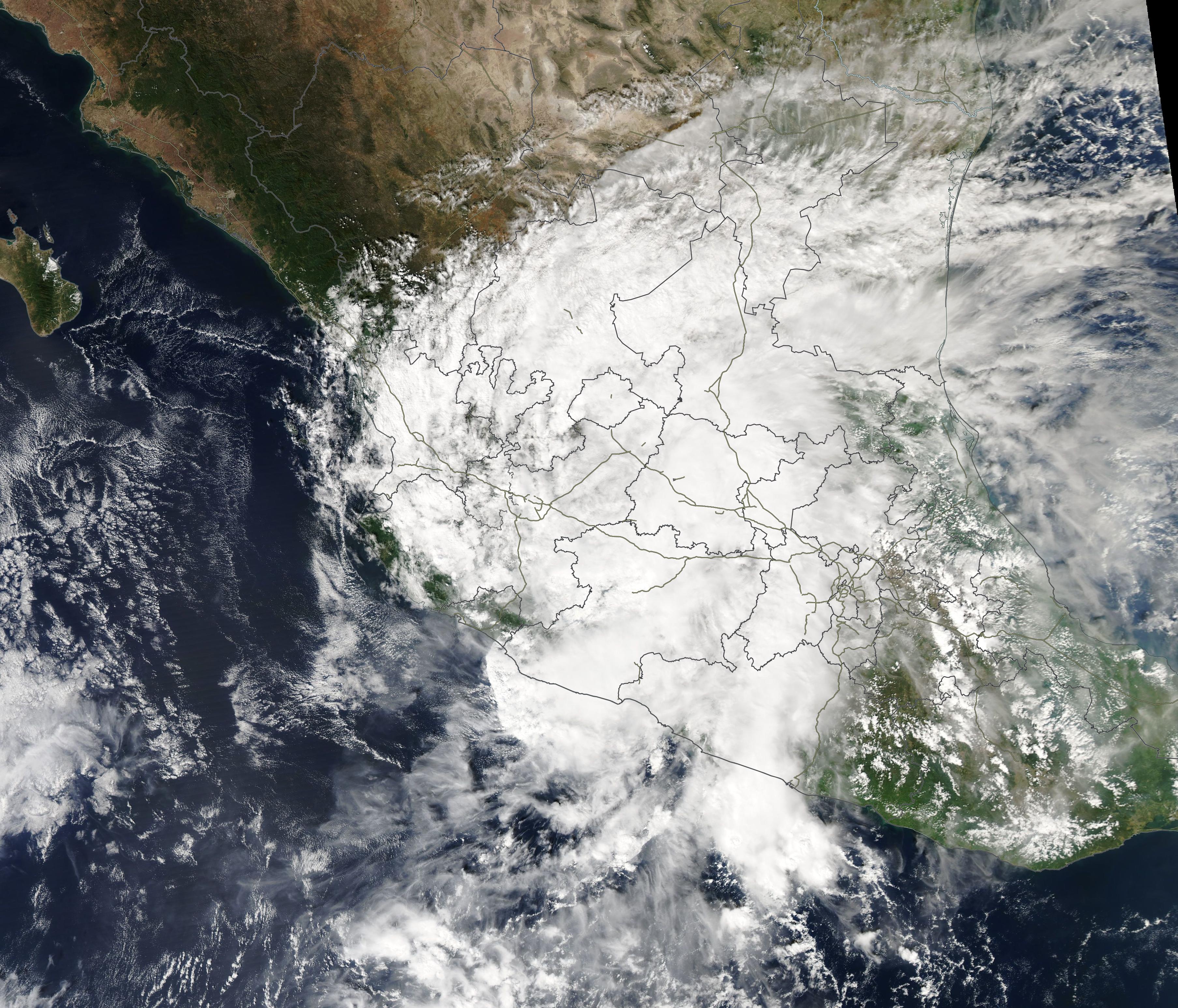
