
Images


November 19, 2021 - Haiti
 Tweet
Tweet
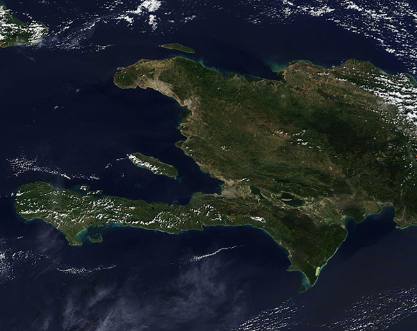
On November 17, 2021, the Moderate Resolution Imaging Spectroradiometer (MODIS) on board NASA's Terra satellite acquired a true-color image of Haiti.
Sitting on the western one-third of the island of Hispaniola, Haiti enjoys an extensive coastline along the North Atlantic Ocean and the Caribbean Sea and shares a land border with the Dominican Republic. The rugged country—the most mountainous in the Caribbean—is just a bit smaller than the U.S. state of Maryland but is home to almost twice as many people. In July 2021, the CIA World Factbook estimate that about 11.2 million people reside in Haiti while Maryland’s population was estimated in the 2020 Census as about 6.1 million.
The beautiful country, which was once heavily forested, extends two long peninsulas into the ocean, forming a semi-circle around the Gulf of Gonave. The Ile de la Gonave sits tucked between the peninsulas, separated from the mainland by the Canal de Saint-Marc in the north and Canal du Sud in the south. The densely populated capital city, Port-au-Prince sits at the tip of the Gulf of Gonave and can be seen in this image as an area of gray, the typical color of human development.
Image Facts
Satellite:
Terra
Date Acquired: 11/17/2021
Resolutions:
1km (175.2 KB), 500m (462.9 KB), 250m (296.7 KB)
Bands Used: 1,4,3
Image Credit:
MODIS Land Rapid Response Team, NASA GSFC
