
Images


December 3, 2021 - Wintery Chill and Lake-effect Snow around Lake Michigan
 Tweet
Tweet
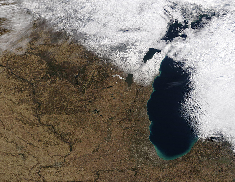
Unsettled weather and cold Canadian air swept over the northern U.S. states of Michigan and Wisconsin repeatedly during the month of November 2021, starting with the first snowfall of the year early in the month. By November 30, when the Moderate Resolution Imaging Spectroradiometer (MODIS) on board NASA’s Terra satellite acquired this true-color image, the final system of the month had dropped light snow on Wisconsin (west) and heavier, lake-effect snow was still falling across Michigan. Snow-filled cloud hangs over eastern Lake Michigan and hides most of western Michigan from view in this image.
Lake-effect snow occurs along the southeastern edge of the Great Lakes when icy wind blows across the lakes from Canada. The wind picks up relatively warm, moist air over the lakes and pushes it over land, where the air is cooler. When the moist air encounters cooler temperatures over land, the water condenses into precipitation. In this case, the cold air crossed Lake Michigan and the precipitation fell as snow.
Image Facts
Satellite:
Terra
Date Acquired: 11/30/2021
Resolutions:
1km (555.3 KB), 500m (1.5 MB), 250m (1.2 MB)
Bands Used: 1,4,3
Image Credit:
MODIS Land Rapid Response Team, NASA GSFC
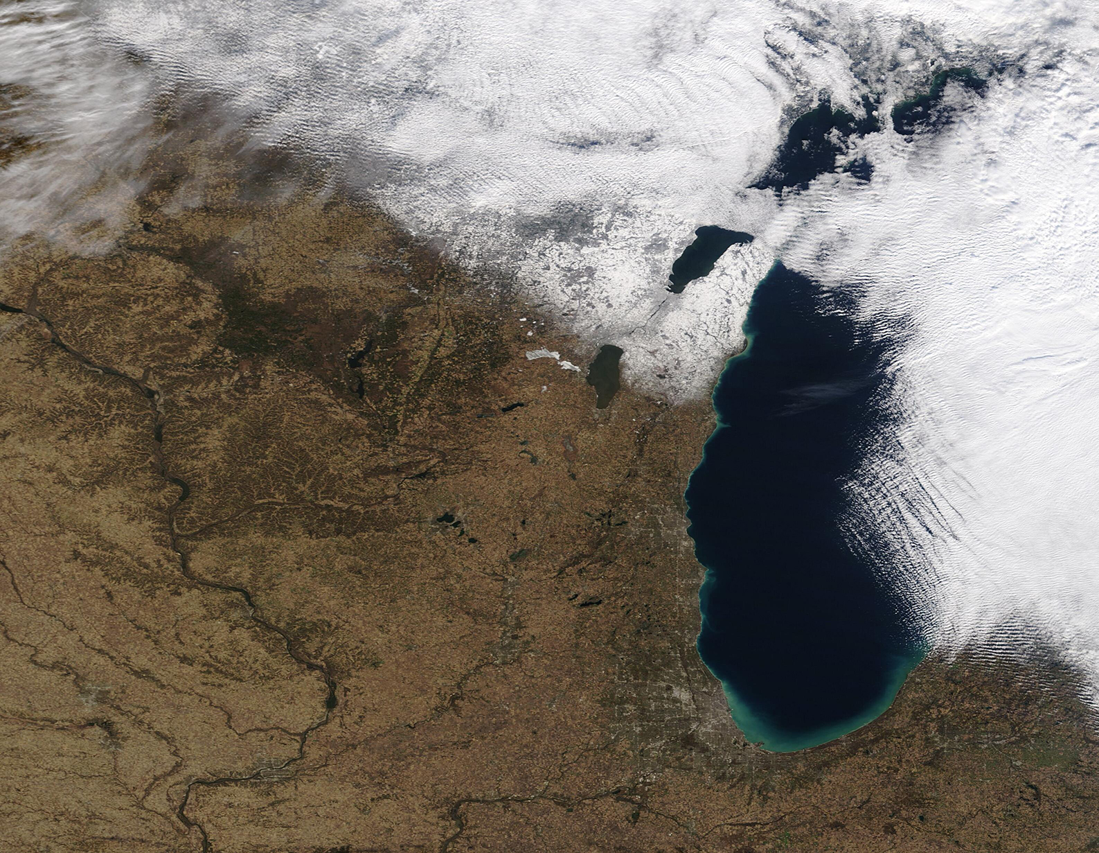
