
Images
January 22, 2024 - Cloud Streets over Lake Superior
 Tweet
Tweet
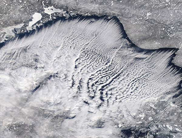
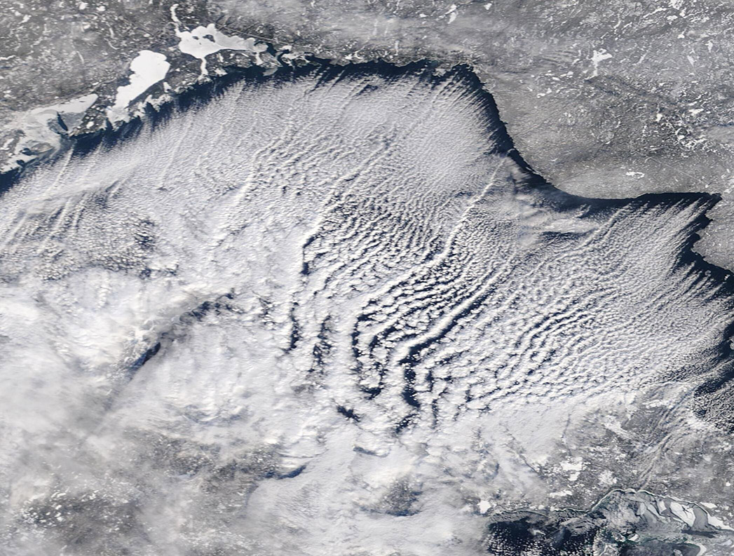
As a bitter Arctic chill swept southward in mid-January 2024, it brought bone-chilling temperatures to much of the United States. The frigid blast helped ice form on the Great Lakes and created gorgeous cloud patterns over Lake Superior.
On January 5, after a relatively warm start to winter, only 1 percent of the surface of Lake Superior was covered by ice, according to the NOAA-Great Lakes Environmental Research Laboratory (GLERL). By January 21, after weeks of winter storms and steadily plummeting temperatures, that lake’s ice cover had risen to 6.02 percent. For the entire Great Lakes, ice cover was only 0.70 percent as of January 5 and had grown to 14.07 percent on January 21. That still remains well under the historical average of about 22 percent Great Lakes ice cover for that date.
An image of amazing “cloud streets” over Lake Superior was captured by the Moderate Resolution Imaging Spectroradiometer (MODIS) on NASA’s Terra satellite on January 19. This pattern of cumulus clouds arranged in long, parallel bands is created when very cold, dry air is blown over relatively warm water. In this case, the frigid Arctic blast blew across Lake Superior and collected moisture from the lake’s waters. The warming air began to rise until clouds were formed. The parallel rows align with the direction of the wind.
Image Facts
Satellite:
Terra
Date Acquired: 1/19/2024
Resolutions:
1km (161.8 KB), 500m (355.7 KB), 250m (555 KB)
Bands Used: 1,4,3
Image Credit:
MODIS Land Rapid Response Team, NASA GSFC
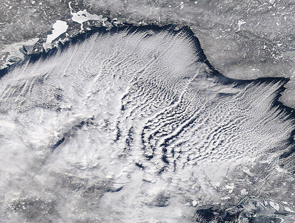
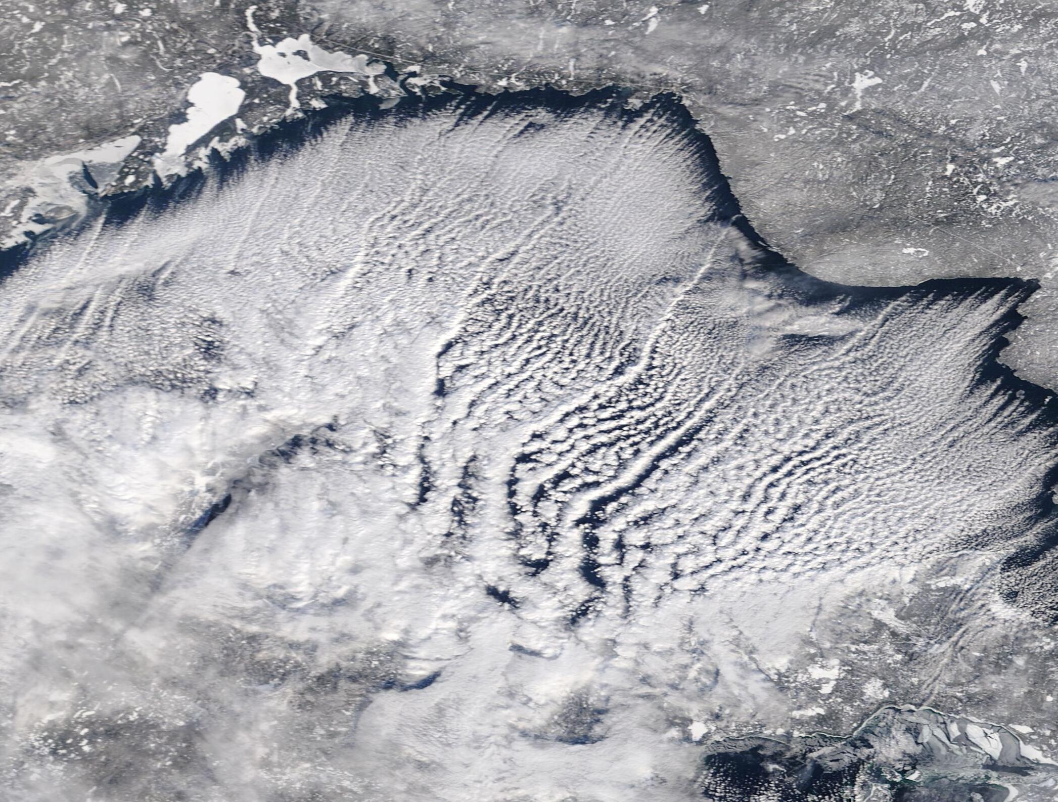
