Hundreds of Fires Spark in Georgia
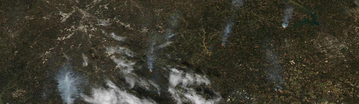
With strong gusting winds, low humidity, and dry vegetation, the state of Georgia was under a red flag warning for extreme fire danger in late February and early March 2025...
Continue ReadingDisciplinary Teams

With strong gusting winds, low humidity, and dry vegetation, the state of Georgia was under a red flag warning for extreme fire danger in late February and early March 2025...
Continue Reading