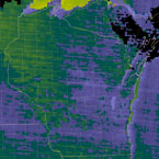
MODIS Total Precipitable Water
Overview

The MODIS Precipitable Water product consists of column water-vapor amounts. During the daytime, a near-infrared algorithm is applied over clear land areas of the globe and above clouds over both land and ocean. Over clear ocean areas, water-vapor estimates are provided over the extended glint area. An infrared algorithm for deriving atmospheric profiles is also applied both day and night for Level 2. There are two MODIS Water Vapor data product files: MOD05_L2, containing data collected from the Terra platform; and MYD05_L2, containing data collected from the Aqua platform.
The Level 2 data are generated at the 1-km spatial resolution of the MODIS instrument using the near-infrared algorithm during the day, and at 5x5 1-km pixel resolution both day and night using the infra-red algorithm when at least nine FOVs are cloud free. The infrared-derived precipitable water vapor is generated as one component of product MOD07, and simply added to product MOD05 for convenience. The solar retrieval algorithm relies on observations of water-vapor attenuation of reflected solar radiation in the near-infrared MODIS channels so that the product is produced only over areas where there is a reflective surface in the near IR.
Product Information
• Validated Stage: Stage 2
• ATBD
• DOI: Gao, B., et al., 2015. MODIS Atmosphere L2 Water Vapor Product. NASA MODIS Adaptive Processing System, Goddard Space Flight Center, USA:
http://dx.doi.org/10.5067/MODIS/MOD05_L2.006 (Terra)
http://dx.doi.org/10.5067/MODIS/MYD05_L2.006 (Aqua)
Product Details
All of the MODIS Total Precipitable Water Data Products can be found at the LAADS Web website.


