
Images


April 30, 2024 - Burn Scars and Frozen Lakes in Western Canada
 Tweet
Tweet
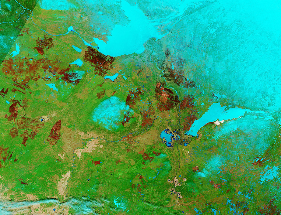
On April 21, 2024, the Moderate Resolution Imaging Spectroradiometer (MODIS) on NASA’s Terra satellite captured a false-color image of western Canada near the Great Slave Lake. Although weather had remained cold enough to keep the lakes ice-covered, April’s sunshine had begun to melt winter’s snow, revealing stark reminders of ferocious wildfires that scorched the region in 2023.
In this type of image, vegetation appears bright green, water looks blue, ice is bright electric blue. Snow also appears electric blue, but usually less intense than ice. Burn scars (areas left after fires have passed) may be black, brown, tan, or brick red. More recent burn scars tend to take on a brick-red hue while scars just a few years old are often dark brown or black. As vegetation begins to grow into burn scars, the color lightens, and eventually green tones begin to hide earlier devastation.
Between the frozen Great Slave Lake (north) and Lake Athabasca (southeast) an exceptionally bright burn scar can be seen near the town of Fort Smith, in Northwest Territories (NWT). This area suffered an extreme fire season in 2023 as the intense burn scar documents.
On April 29, 2024, NWT Fire confirmed that two fires—the first in the new year—had been spotted along the Slave River north of Fort Smith and were being actively fought. These are holdover fires from the 2023 season which had smoldered under the snow and flared up after the snow melted. In 2023, the first wildfire was reported on May 4, almost a month earlier than normal. Despite the earlier start this year, fire weather is not considered as extreme as in early 2023.
Image Facts
Satellite:
Terra
Date Acquired: 4/21/2024
Resolutions:
1km (1.1 MB), 500m (3.4 MB), 250m (9.2 MB)
Bands Used: 7,2,1
Image Credit:
MODIS Land Rapid Response Team, NASA GSFC
