
Images


March 15, 2025 - Aerosol Haze over Uzkbekistan
 Tweet
Tweet
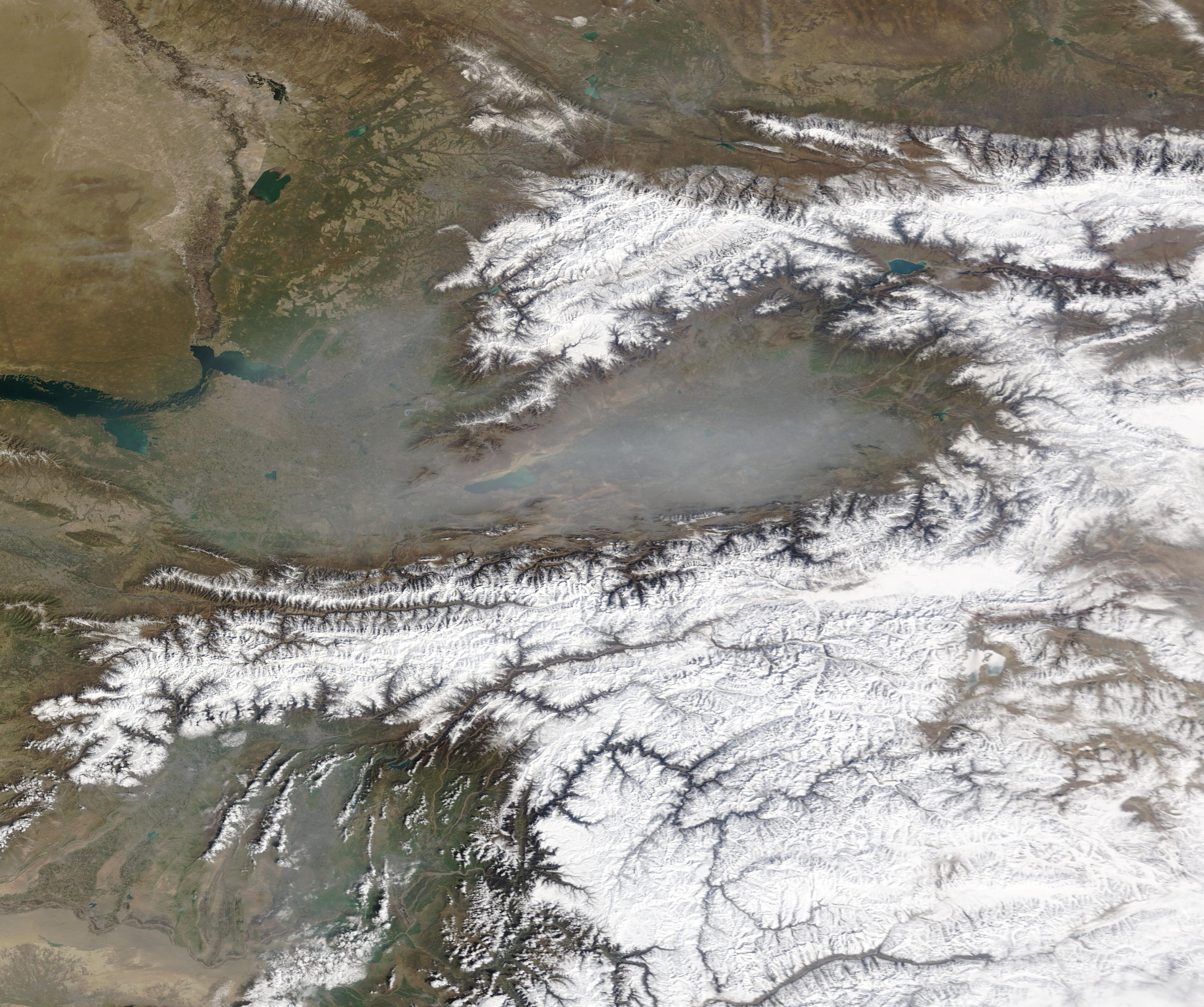
Heavy haze covered most of Uzbekistan on March 14, 2025, when the Moderate Resolution Imaging Spectroradiometer (MODIS) on NASA’s Terra satellite acquired this true-color image. The gray aerosol haze filled the Fergana Valley as well as lowlands north and west of the snow-topped Tian Shen Mountains.
According to local news media, a sharp cold snap and snowfall in Tashkent on the morning of March 13 was followed by poor air quality by that same evening. By the next morning, thick smog had settled over the city. Tashkent is the capital of Uzbekistan, sitting in the Chirchiq River valley west of the Chatkal Mountains. The Chatkal Mountains are part of the western Tian Shan Mountains that form the northwest border of the Ferghana Valley.
The cold weather likely triggered a temperature inversion, which contributed to the buildup of airborne particulate matter (aerosols) that created the haze. Inversions occur when cold air gets trapped under a layer of warm air. Usually, air high in the atmosphere is cooler than air near Earth’s surface. Warmer air near the surface rises, allowing pollutants from the surface to disperse in the atmosphere. During the winter, cold air often moves down the high elevations of mountains to settle over the lower valleys at their feet. This layer of cold air gets trapped beneath a layer of warmer air. Since the cold air cannot rise above the warm air, pollution builds in the cold air as long as the temperature inversion lasts.
The cold snap likely also increased the use of coal, which is widely used to produce heat by coal-fueled power plants. Radio Free Europe reported that, in the winter of 2023, the government planned to use coal to heat 2,229 kindergartens, 2,432 schools and other education institutions, and 746 medical facilities in an attempt to help save natural gas supplies, which are inadequate. The poor air quality in Tashkent and surrounding areas has been blamed on not only the extensive use of coal but also the large number of vehicles that use low-quality fuel as well as a declining number of trees.
Image Facts
Satellite:
Terra
Date Acquired: 3/14/2025
Resolutions:
1km (291.1 KB), 500m (711.2 KB), 250m (1.6 MB)
Bands Used: 1,4,3
Image Credit:
MODIS Land Rapid Response Team, NASA GSFC
