
Images


March 19, 2025 - Waves in the Clouds around the South Sandwich Islands
 Tweet
Tweet
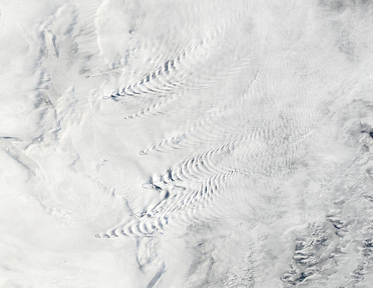
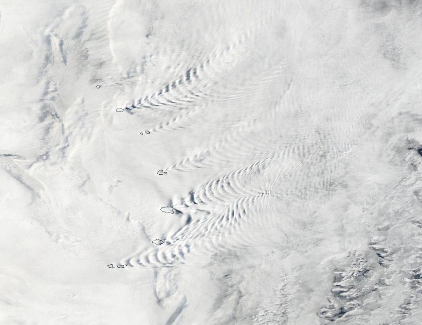
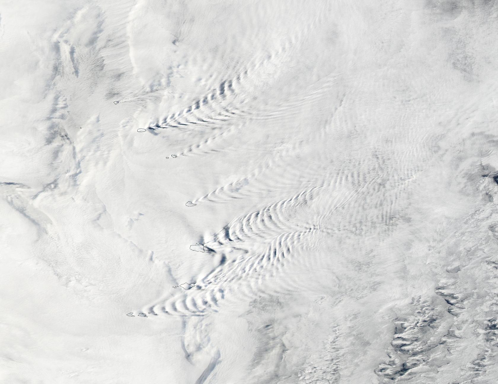
On March 17, 2025, the Moderate Resolution Imaging Spectroradiometer (MODIS) on NASA’s Aqua satellite captured this stunning true-color image of wave clouds etched in a broad bank of clouds around the South Sandwich Islands.
The South Sandwich Islands are a remote group of eleven small volcanic peaks arranged in an arc in the southern Atlantic Ocean. They sit about 1,000 miles (1,600 kilometers) northeast of the Antarctic Peninsula and within the Scotia Sea, a frigid body of water littered with icebergs and under the sway of the powerful Antarctic Circumpolar Current.
Spread across an often cloudy region known as the Furious Fifties, the steep, conical islands have persistent westerly winds sweeping past them. This combination of winds and topography helps produce a range of unusual and beautiful cloud types, including wave clouds, volcano tracks, and lenticular clouds.
On this day, the prevailing winds struck the tall peaks in a manner that caused the air to push past them in a symmetric pattern, causing the air to ripple on the lee side in an expanding pattern. This v-shaped pattern, which is anchored at the island and spreads out behind, is called a “wave cloud”, because it looks much like the waves that a ship might make as it moves through water.
Image Facts
Satellite:
Aqua
Date Acquired: 3/17/2025
Resolutions:
1km (61.2 KB), 500m (218.9 KB), 250m (690.6 KB)
Bands Used: 1,4,3
Image Credit:
MODIS Land Rapid Response Team, NASA GSFC
