Images
February 8, 2020 - Tropical Cyclone Damien
Tweet
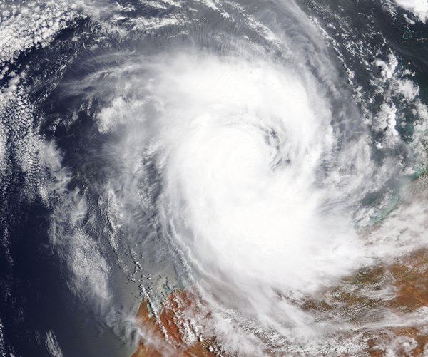
Severe Tropical Cyclone Damien was intensifying as it crept towards Australia’s Pilbara Coast in early February, 2020. The Moderate Resolution Imaging Spectroradiometer (MODIS) on NASA’s Terra satellite acquired a true-color image of the storm on February 7.
At 11:46 pm WST (10:46 a.m. EST) on that date, the Australian Bureau of Meteorology (ABM) reported that Damien was a Category 3 storm with maximum sustained winds near the center of 140 kilometers (87 miles) per hour with higher wind gusts. Damien was located near latitude 18.9 degrees south and longitude 16.7 degrees east, about 205 kilometers (127 miles) north of Karratha and 255 kilometers (158 miles) northwest of Port Hedland. Damien is moving to the south-southwest.
Forecasters at the ABM noted: “Severe Tropical Cyclone Damien (Category 3) is expected to intensify as it moves towards the Pilbara coast. Damien is likely to cross the coast between Whim Creek and Mardie during Saturday as a Category 4 system. Later on Saturday or Sunday, Damien will move inland and weaken.”
Image Facts
Satellite:
Terra
Date Acquired: 2/7/2020
Resolutions:
1km (1.1 MB), 500m (3.1 MB), 250m (2.4 MB)
Bands Used: 1,4,3
Image Credit:
MODIS Land Rapid Response Team, NASA GSFC


