
Images


May 9, 2024 - Cirrus Clouds off Chile
 Tweet
Tweet
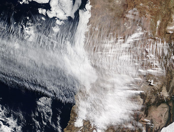
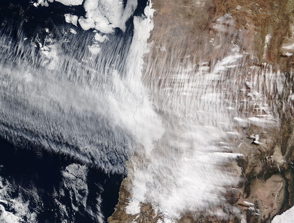
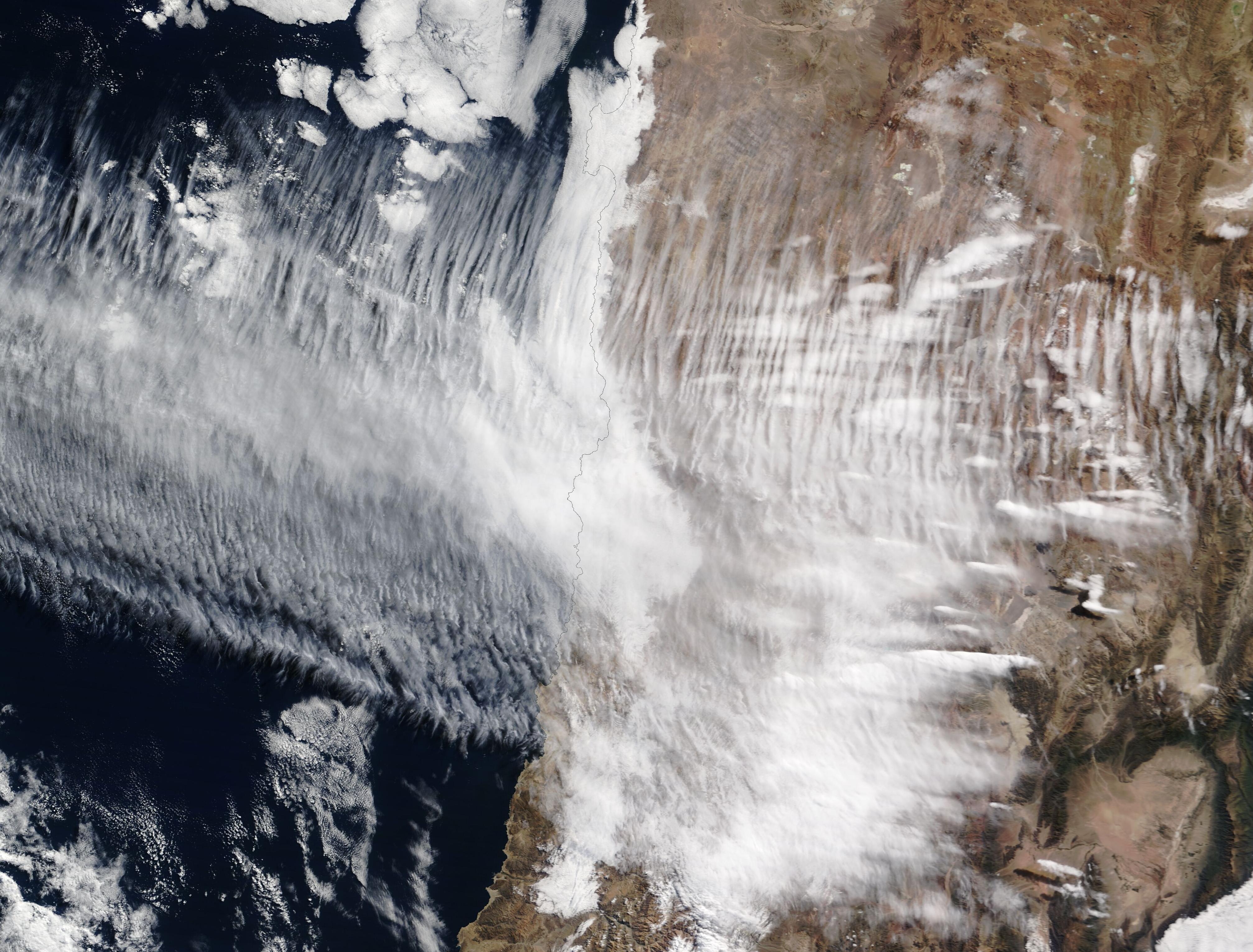
High-altitude cirrus clouds stretched across the Pacific Ocean and central Chile on May 7, 2024. The Moderate Resolution Imaging Spectroradiometer (MODIS) on NASA’s Terra satellite acquired a true-color image of the striking cloud pattern on that same day.
The word “cirrus” is derived from the Latin word “cirro”, which means a curl of hair. It’s a good description of these high, wispy clouds which are composed of ice crystals. There are various types of cirrus clouds, but these filamentous streaks often mean bad weather is on the way, as they are the first to appear in advance of a low-pressure system, such as a mid-latitude storm.
Such appeared to be the case with the clouds captured in this image. At the same time this image was acquired, a strong frontal system was bringing high wind and heavy snow just south of the wispy clouds. By May 8, the area near Santiago, Chile (south of the image) was blanketed under fresh snow, traffic was disrupted, and power was out for approximately 225,000 residents, according to news reports. Even further south, the same system dumped 4 feet (1.2 meters) in lower elevations and up to 8 feet (2.4 meters) in the mountains near Bariloche, Argentina.
Image Facts
Satellite:
Terra
Date Acquired: 5/7/2024
Resolutions:
1km (247.5 KB), 500m (575.7 KB), 250m (1.2 MB)
Bands Used: 1,4,3
Image Credit:
MODIS Land Rapid Response Team, NASA GSFC
