
Images


May 30, 2015 - Phytoplankton bloom in Bass Strait, Australia
 Tweet
Tweet
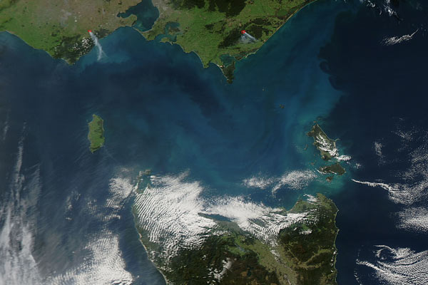
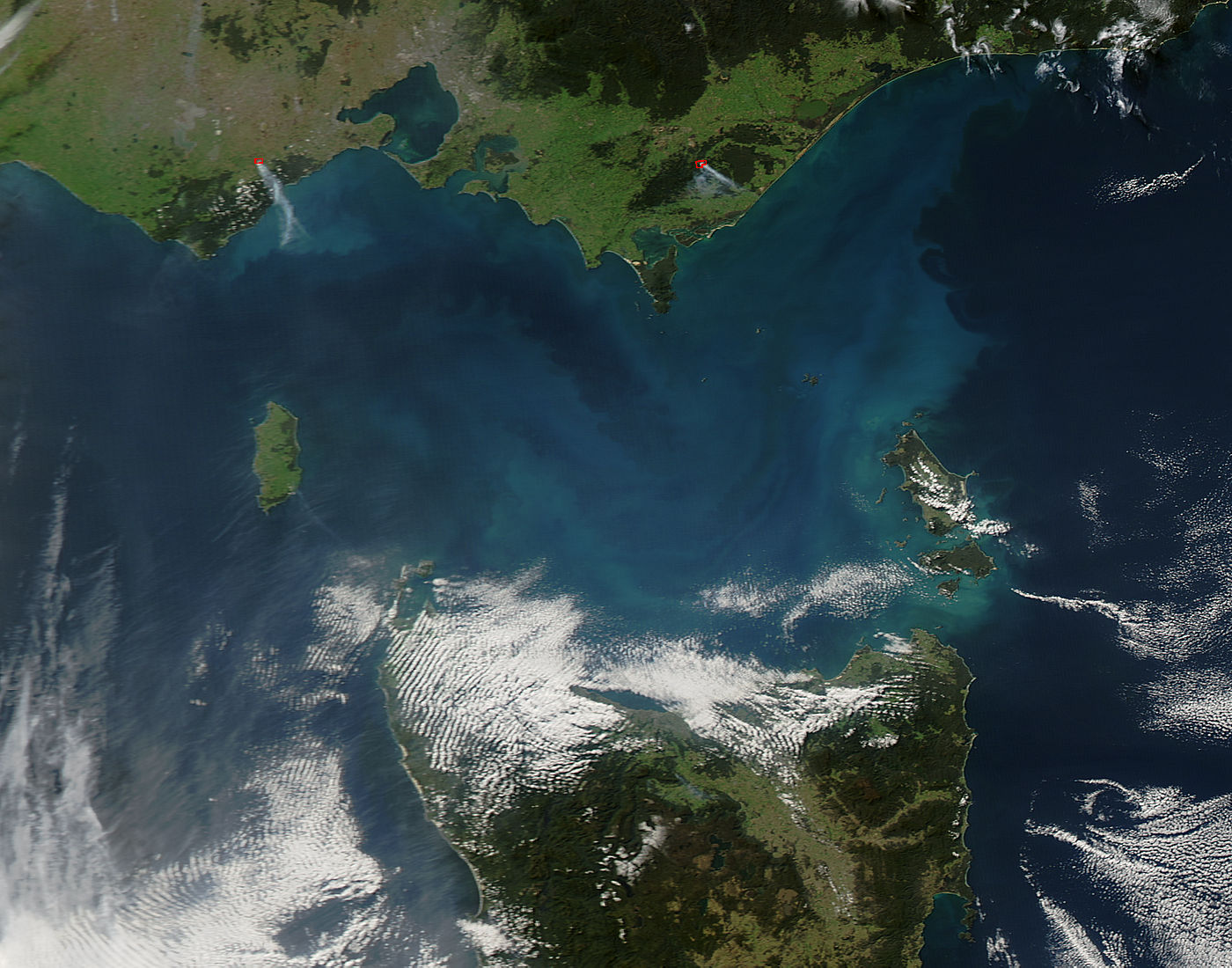
Swirls of aqua and peacock colored the waters of the Bass Strait in mid-May, 2015. The Moderate Resolution Imaging Spectroradiometer (MODIS) aboard NASA’s Aqua satellite captured this true-color image on May 18.
The Bass Strait separates the Australian states of Tasmania (south) and Victoria (north). Said to be “twice as wide and twice as rough” as the English Channel, the waters of the strait have been notoriously dangerous for traditional sailing and merchant ships. The waters are relatively shallow – the average depth is 60 m, with the sea floor under the strait considered a bridge of continental shelf connecting the mainland to Tasmania. The topography of the floor of the Strait has been described as a “perched valley, with the eastern and western margins of the Strait being slightly raised granite ridges.
This topography helps create a very biodiverse marine ecosystem. The Strait is known for its rich sponge beds and for providing a site for the aggregation of whales, particularly the blue whale. As diverse as the region is, new discoveries are still being made. A paper published in 2014, in a journal from the Public Library of Science, describes the discovery of two new species of organisms in the deep drop of the Australian continental slop off the eastern Strait. They belong to a new genus, Dendrogramma in a new family, Dendrogrammatidae. They share some similar traits with the phyla containing comb jellies, and the phyla containing jellyfish, hydra, sea anemones and corals – but had never before been described by science.
Phytoplankton, which bloom so profusely in the Bass Strait when conditions are favorable, form the base of the marine food chain. Like land plants, phytoplankton have chlorophyll to capture sunlight, and they use photosynthesis to turn it into chemical energy. They consume carbon dioxide, and release oxygen.
Image Facts
Satellite:
Aqua
Date Acquired: 5/18/2015
Resolutions:
1km (93.7 KB), 500m (298.5 KB), 250m (707.2 KB)
Bands Used: 1,4,3
Image Credit:
Jeff Schmaltz, MODIS Land Rapid Response Team, NASA GSFC
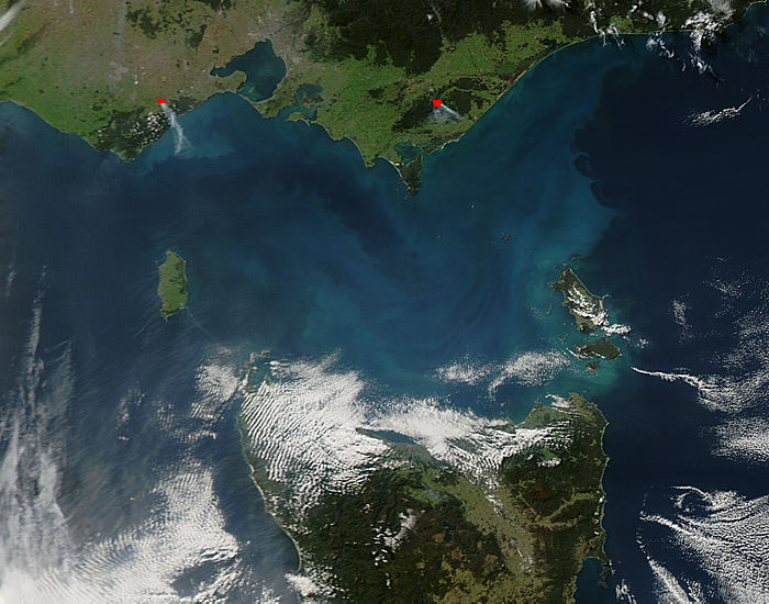
