
Images


April 20, 2024 - Ice Retreat Begins on Hudson Bay
 Tweet
Tweet
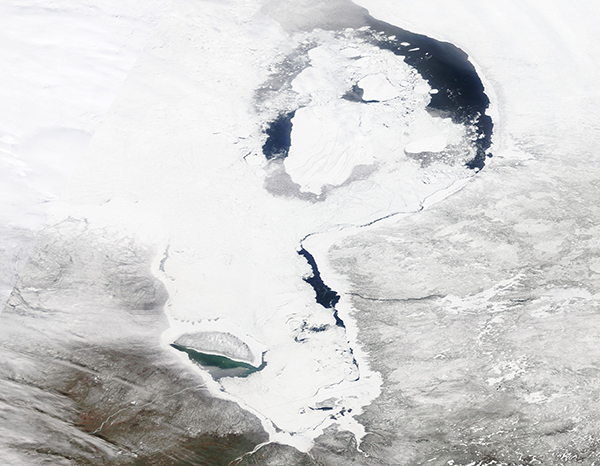
On April 14, 2024, the Moderate Resolution Imaging Spectroradiometer (MODIS) on NASA’s Terra satellite acquired a true-color image of early signs of ice retreat in Hudson Bay.
Clouds and ice thoroughly cover the western half of Hudson Bay, but areas of open water are obvious in the east off the coast of Quebec province. In the south, ice retreat can also be seen off the eastern coast of James Bay as well as south of Akimiski Island.
Snow covers the landscape of the Canadian provinces of Ontario (west) and Quebec (east), evidence that temperatures remain relatively winter-like. Reports from Weather Underground, however, show high temperatures reaching the 40°F (4.4°C) range at Wemindji Airport, Quebec, repeatedly during the month of April.
Traditionally, ice break-up begins in May or June along the eastern and southern coasts, as daylight lengthens and temperatures rise. Hudson Bay does not become completely ice-free until late July or August. At times, cold snaps as late as May can cause ice to begin to refreeze or thicken.
Image Facts
Satellite:
Terra
Date Acquired: 4/17/2024
Resolutions:
1km (699.7 KB), 500m (2 MB), 250m (1.4 MB)
Bands Used: 1,4,3
Image Credit:
MODIS Land Rapid Response Team, NASA GSFC
