
Images


August 23, 2015 - The Mediterranean
 Tweet
Tweet
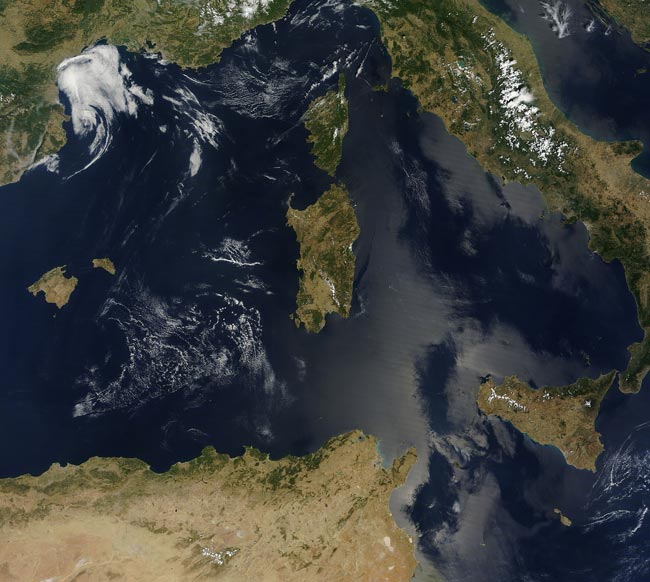
NASA’s Terra satellite flew over the Mediterranean region on July 16, 2015 allowing the Moderate Resolution Imaging Spectroradiometer (MODIS) flying aboard captured this true-color image of a sunny, almost cloud-free summer day.
The Mediterranean basin stretches about 2,300 mi (3,800 km) west to east from Lebanon to Portugal, and about 620 mi (1,000 km) south to north from Morocco and Libya to Italy. The countries captured in this image include, from west to east, starting in the north: Spain, France, Monaco and Italy. To the east of Italy sits the Adriatic Sea. In the south Algeria is in the west, and Tunisia in the east. The large island of Sicily sits at the tip of the “boot” of Italy, while Sardinia and Corsica are in the center of this section of the Mediterranean Sea.
Image Facts
Satellite:
Terra
Date Acquired: 7/16/2015
Resolutions:
1km (490.3 KB), 500m (2.1 MB), 250m (4.9 MB)
Bands Used: 1,4,3
Image Credit:
Jeff Schmaltz, MODIS Land Rapid Response Team, NASA GSFC
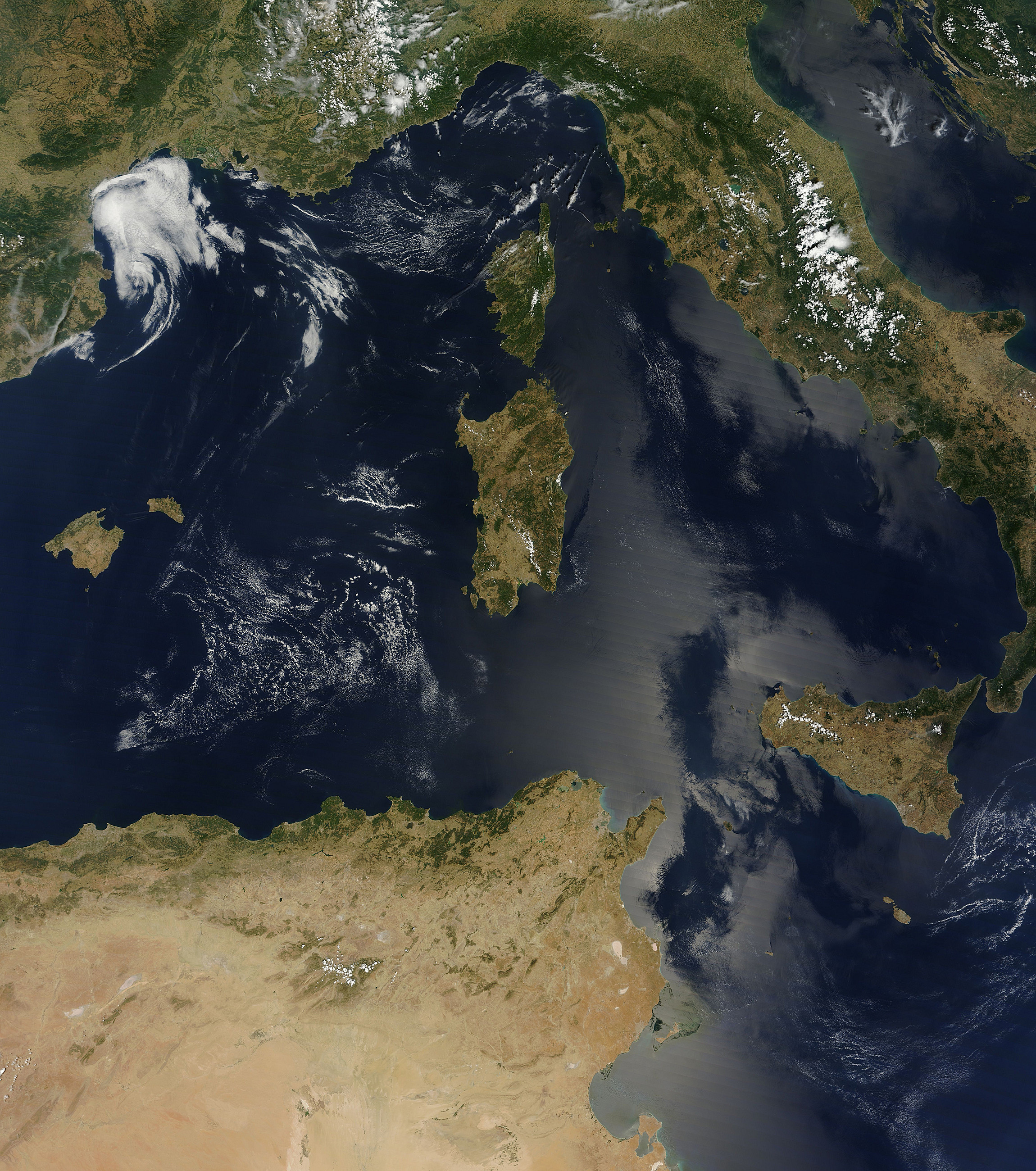
