
Images


October 11, 2015 - Hurricane Marty (17E) over Mexico
 Tweet
Tweet
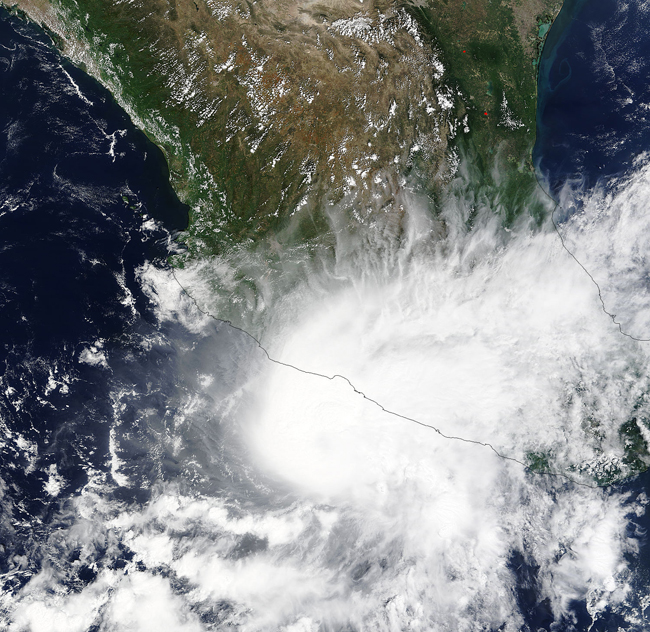
On September 28, 2015, the Moderate Resolution Imaging Spectroradiometer (MODIS) aboard NASA’s Terra satellite captured a true-color image of a near-peak-strength Hurricane Marty spinning along the western coast of Mexico.
The storm began as the seventeenth tropical depression of the Eastern Pacific this year and formed about 5:00 p.m. EDT on September 26 about 300 southwest of Acapulco, Mexico. By 11:00 p.m. that same day, the depression had strengthened into Tropical Storm Marty. Never a strong storm, Marty reached Category 1 Hurricane status late in the day on September 28 when maximum one-minute sustained winds peaked at about 80 mph (130 km/h). The peak was short-lived, and Marty was downgraded to a tropical storm by the afternoon of September 29 and became a tropical depression the next day before fading to a remnant low on October 1.
Marty was neither a strong storm, nor a long-lived one, but it carried heavy rainfall to parts of Mexico, increasing the risk of flooding and landslide. It also kicked up strong swells and potential dangerous riptides along the coast.
Image Facts
Satellite:
Terra
Date Acquired: 9/28/2015
Resolutions:
1km (845.1 KB), 500m (2.8 MB), 250m (6.7 MB)
Bands Used: 1,4,3
Image Credit:
Jeff Schmaltz, MODIS Land Rapid Response Team, NASA GSFC
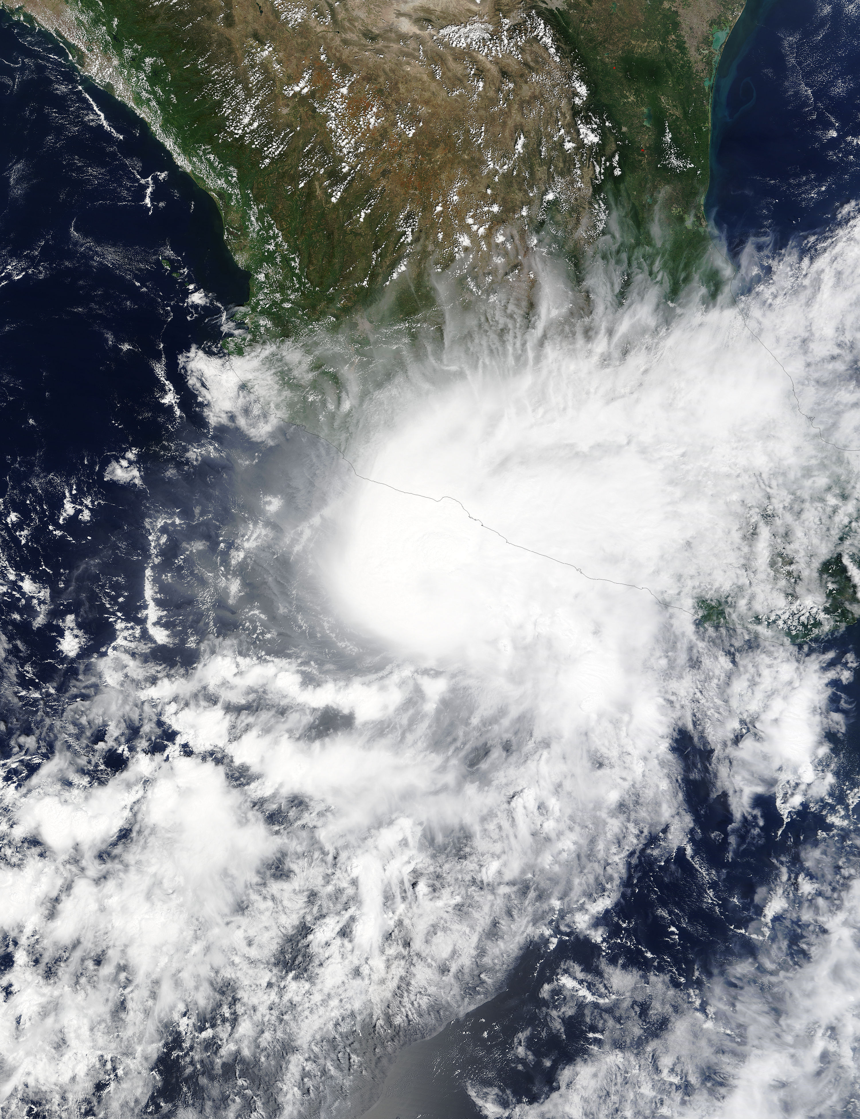
