
Images


October 15, 2018 - India, Nepal, and Tibet
 Tweet
Tweet
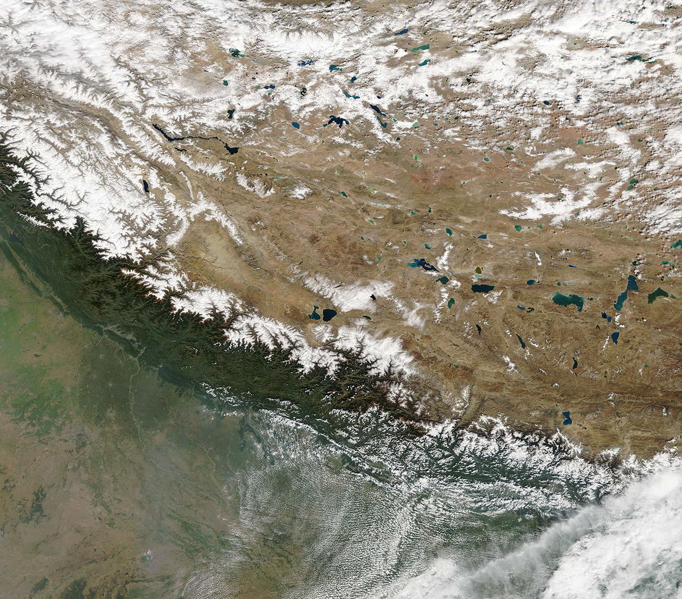
A cool, nearly cloudless day allowed a clear-sky view of Tibet and haze-shrouded areas of Nepal and India in mid-October, 2018.
The Moderate Resolution Imaging Spectroradiometer (MODIS) flying onboard NASA’s Terra satellite captured this true-color image on October 12. The Tibetan plateau, part of the Tibetan Autonomous Region of China, can be seen in the north of the image. Nepal lies primarily in the mountains south of Tibet and north of India.
The Tibetan Plateau is home to more than 1,500 large and small lakes that cover 24,183 square kilometers (9,337 square miles). It has been called the “Roof of the World” for its high altitude and also has earned the nickname “The Land of the Snows” due to the possibility of snowfall during any month of the year, as well as the heavy snow expected in winter. The area is also the source of many of Asia’s major rivers, including the Brahmaputra, Indus, Ganges, Salween (Nu Jiang), Mekong (Lancang Jiang), Yangtze (Chang Jiang), and Yellow (Huang He) Rivers. In this image, sapphire lakes dot the plateau’s rugged surface, while snow caps many of the mountain peaks.
The Himalaya Mountains rim the southern edge of the Tibetan Plateau. The mountain ranges sport snow-capped peaks intermingling with dark, vegetated slopes. The peaks and the northern slopes are covered with snow while the southern and southwestern slopes appear to remain relatively snow-free, suggesting warmer temperatures.
In the lower elevations south of the Himalaya Mountains, not only is snow scarce, but the air is no longer clear. Haze from industry, agricultural fires, and other sources hangs in the atmosphere over northern India – a frequent occurrence in this region.
Image Facts
Satellite:
Terra
Date Acquired: 10/12/2018
Resolutions:
1km (1.7 MB), 500m (4.7 MB), 250m (4.5 MB)
Bands Used: 1,4,3
Image Credit:
MODIS Land Rapid Response Team, NASA GSFC
