
Images


December 16, 2018 - Severe Tropical Cyclone Owen
 Tweet
Tweet
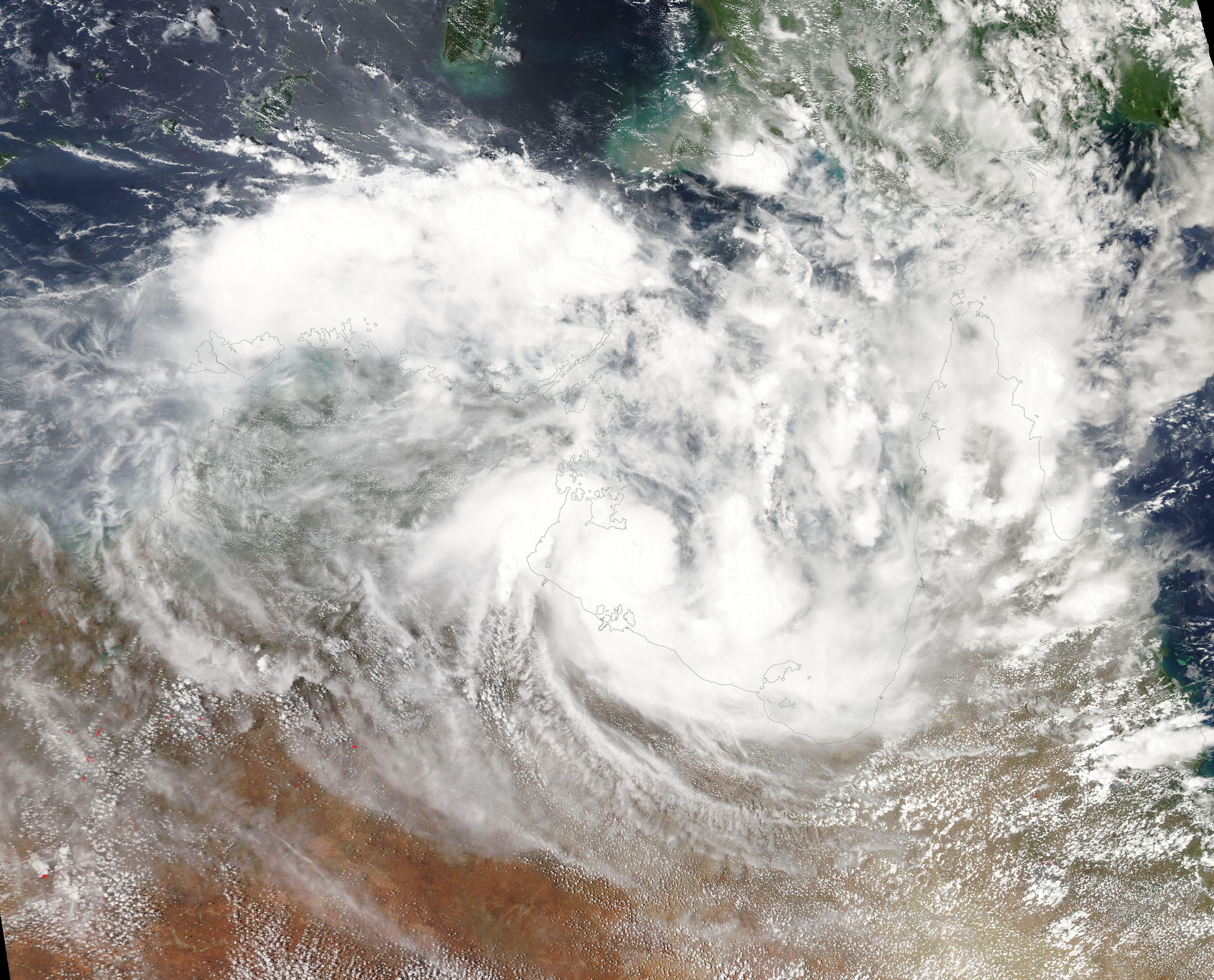
Tropical Cyclone Owen sprung to life from a low pressure area circulating in the Coral Sea northeast of Australia on December 2, 2018. It strengthened and tracked westward, crossing the Cape York Peninsula in far northern Queensland on December 10 at tropical storm strength, with winds around 40 mph (64 km/h). It weakened as it crossed land and continued to track west over the Gulf of Carpentaria.
As the storm approached the eastern shore of Northern Territory it met with a strong change in wind, then turned strongly back in a near-U-turn and headed back towards the Cape York Peninsula. Tropical Cyclone Owen strengthened as it re-crossed the Gulf of Carpentaria, reaching peak wind speeds equivalent to a Category 1 hurricane on the Saffir-Simpson Hurricane Wind Scale.
On December 14 at 10 p.m. AEST (local time, Queensland) or 7 a.m. EST, Owen was located near 15.3 degrees south and 140.6 degrees east, estimated to be 75 mi (120 km) west southwest of Pormpuraaw and 99 mi (160 km) north northwest of Gilbert River Mouth, in Queensland. The storm was moving east at 31 km/h (19 mph) and carrying maximum sustained winds near the center of 75 mph (120 km/h).
Tropical Cyclone Owen made landfall in the early morning of December 15, local time, between Kowanyama and the Gilbert River Mouth early Saturday morning, local time with maximum wind speeds close to 75 mph (120 km/h), the equivalent of a low-end Category 1 storm on the Saffir-Simpson scale. After striking land, Owen weakened rapidly and turned towards the south-east, missing centers of high population. The Joint Typhoon Warning Center (JTWC) issued its final bulletin on Owen on the afternoon of December 15 as the storm was dissipating over land.
The Moderate Resolution Imaging Spectroradiometer (MODIS) on board NASA’s Terra satellite acquired a true-color image of Tropical Cyclone Owen on December 12 as it moved over the Gulf of Carpentaria.
Image Facts
Satellite:
Terra
Date Acquired: 12/12/2018
Resolutions:
1km (3 MB), 500m (7.9 MB), 250m (6.3 MB)
Bands Used: 1,4,3
Image Credit:
MODIS Land Rapid Response Team, NASA GSFC
