
Images


February 20, 2019 - Fires and Snow in the Pyrénées Mountains
 Tweet
Tweet
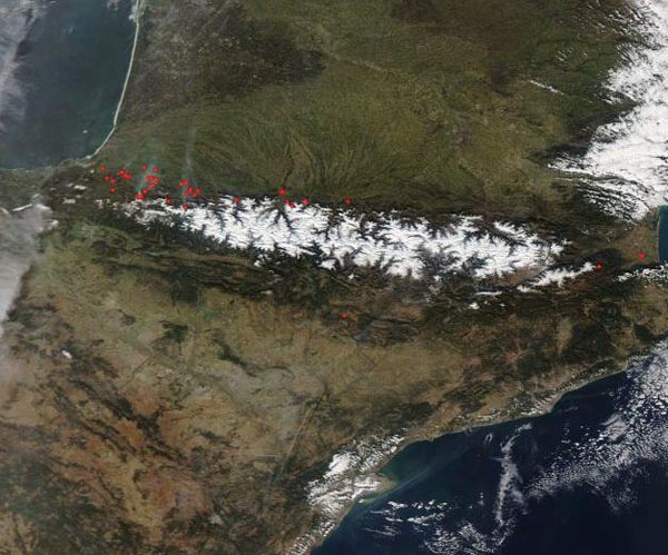
A number of fires burned along the foothills of the snow-capped Pyrenees Mountains in mid-February, 2019. The Moderate Resolution Imaging Spectroradiometer (MODIS) on board NASA’s Aqua satellite acquired a true-color image of the mountainous region on February 18.
Each red “hot spot” marks an area where the thermal bands on the MODIS instrument detected high temperatures. When combined with typical smoke, as in this image, such hot spots mark actively burning fire. Most of the fires occur in southwestern France, although a few can be seen in France east of the Pyrénées and along the southern slope in Spain. Haze hangs in the air over southwestern France, likely the result of the fires.
While it is not possible to determine the cause of fires in a satellite image, given the time of year and location, most of these fires are likely agricultural in origin, which means they have been deliberately set to manage land. Called “écobuage” in this area (or “controlled burn” in English), such fires are often used to enhance productivity in croplands or renew pasture. In many areas, such as the Pyrénées, such fires fall under strong legal control, with farmers being required to obtain a license before igniting a burn. On February 18, the weather in the region was sunny with little wind – ideal conditions for igniting and managing agricultural burns.
Image Facts
Satellite:
Aqua
Date Acquired: 2/18/2019
Resolutions:
1km (65.5 KB), 500m (229.2 KB), 250m (715 KB)
Bands Used: 1,4,3
Image Credit:
MODIS Land Rapid Response Team, NASA GSFC
