
Images


April 20, 2019 - Zambezi River Valley
 Tweet
Tweet
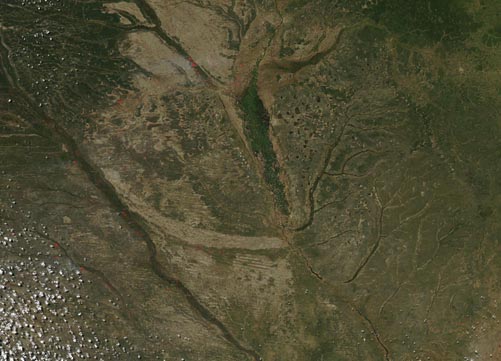
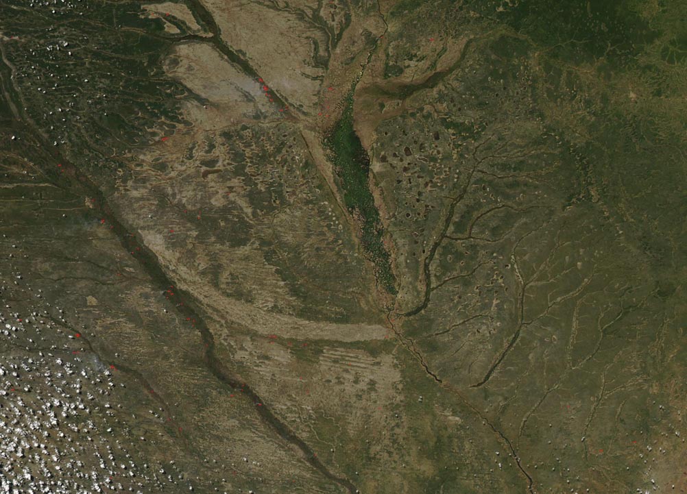
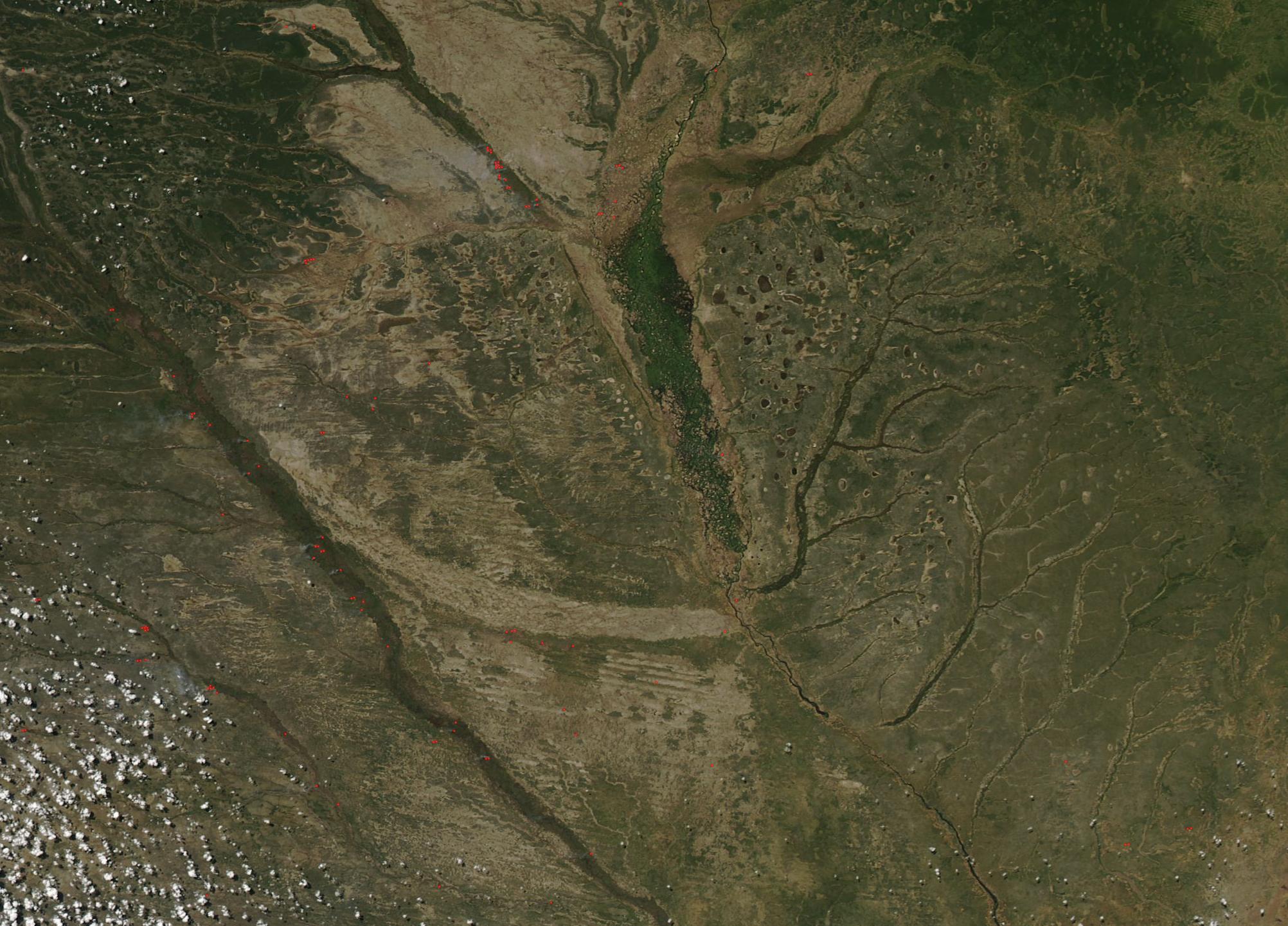
The Zambezi River is the fourth-longest river in Africa, with a basin of about 540,000 square miles (1,390,000 sq km). It flows 1,599 miles (2,574 km) from the source in Zambia to the Indian Ocean, running through eastern Angola, along the north-eastern border of Namibia, the northern border of Botswana, the border of Zimbabwe then through Mozambique.
The Moderate Resolution Imaging Spectroradiometer (MODIS) on board NASA’s Aqua satellite acquired a true-color image centered on the Zambezi River on March 31, 2019.
Nearly every April, Africa’s Zambezi River swells with seasonal rain, spreading across its broad flood plain, sometimes causing significant flooding. According to the National Oceanic and Atmospheric Administration’s (NOAA) Climate Prediction Center, prolonged seasonal rainfall deficits since the beginning of the southern African monsoon have negatively impacted the grounds of many countries in the region this year, including southern Angola, northern Namibia, southern Zambia, and northern Zimbabwe. Wilting conditions and dried up dams were reported over some areas. Despite the lower than average rainfall, the Zambezi River Valley, seen near the center of the image, appears green suggesting adequate rain to bring a flush of vegetative growth in this location.
Image Facts
Satellite:
Aqua
Date Acquired: 3/31/2019
Resolutions:
1km (54.6 KB), 500m (165 KB), 250m (422.4 KB)
Bands Used: 1,4,3
Image Credit:
MODIS Land Rapid Response Team, NASA GSFC
