
Images


October 20, 2019 - Fires in Pakistan and India
 Tweet
Tweet
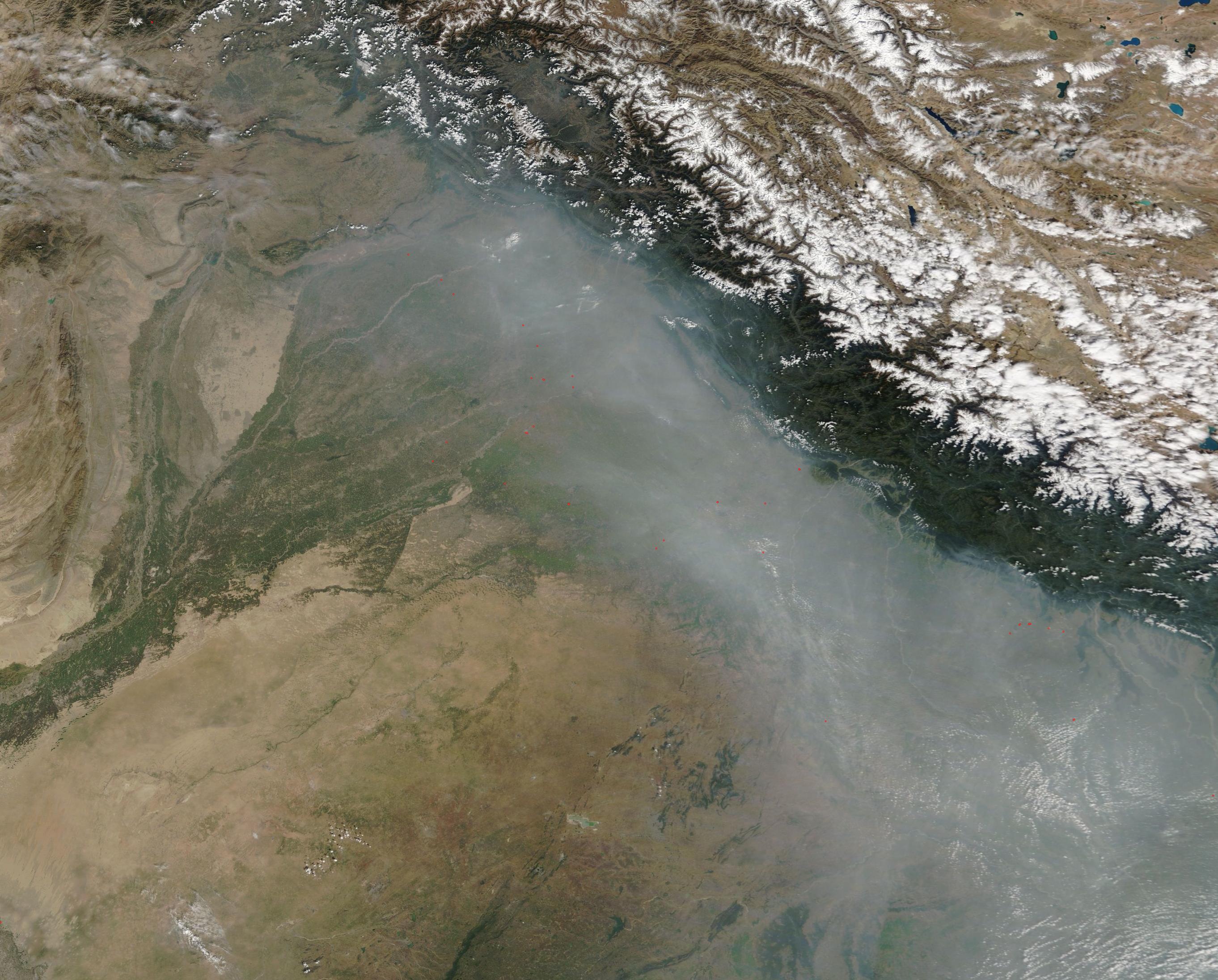
A thick layer of smoke lay over northeast Pakistan and northwestern India on October 16, 2019, when the Moderate Resolution Imaging Spectroradiometer (MODIS) on board NASA’s Terra satellite acquired a true-color image of the scene. Dozens of red “hot spots” punctuate the smoky haze, each marking an area where the thermal bands on the instrument detected high temperatures. When combined with typical smoke, as in this image, such hot spots mark actively burning fire. The location, widespread nature, and time of year suggest these fires are agricultural in nature, deliberately set by farmers to manage land for crops or pasture.
There are two main growing seasons in this region and mid-October falls between the end of the first (kharif) and the start of the second (rabi). For the kharif, crops are planted as the rains begin in May through July and are harvest as the monsoon season comes to an end in September through October. The winter cropping season (rabi) begins quickly, with crops planted from October to December and harvested by February through April. In the traditional agriculture of the region, fire can be used to burn stubble at the end of each growing season and to prepare fields prior to planting.
Image Facts
Satellite:
Terra
Date Acquired: 10/16/2019
Resolutions:
1km (235.5 KB), 500m (812.2 KB), 250m (2.6 MB)
Bands Used: 1,4,3
Image Credit:
MODIS Land Rapid Response Team, NASA GSFC
