
Images


April 2, 2020 - Fires continue in Southeast Asia
 Tweet
Tweet
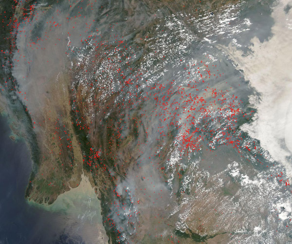
Smoke from hundreds of fires shrouded Southeast Asia on April 1, 2020, evidence of extension of a long and intense fire season across the region.
The Moderate Resolution Imaging Spectroradiometer (MODIS) on board NASA’s Aqua satellite acquired this true-color image on that same day.
The highest number of fires burn in Laos, near the center of the image, and Myanmar in the west. Lower numbers can be seen in Thailand, Cambodia and southern Vietnam. A bank of low cloud (fog) lays across most of northern Vietnam, obscuring any hot spots, which marking actively burning fires. Dense smoke spans the entire region, even making the fog appear a dirty gray.
Every January through March, vast numbers of small fires spring up across the countryside in Southeast Asia. Those months usually bring cool, dry weather—perfect conditions for burning. Given the location, time of year, and widespread nature of these fires, they are likely primarily agricultural fires which have been deliberately set to manage land for agricultural reasons, such as clearing new fields, burning old crops, and preparing cropland and pastures for the next season.
Image Facts
Satellite:
Aqua
Date Acquired: 4/1/2020
Resolutions:
1km (350.8 KB), 500m (1.1 MB), 250m (4.6 MB)
Bands Used: 1,4,3
Image Credit:
MODIS Land Rapid Response Team, NASA GSFC
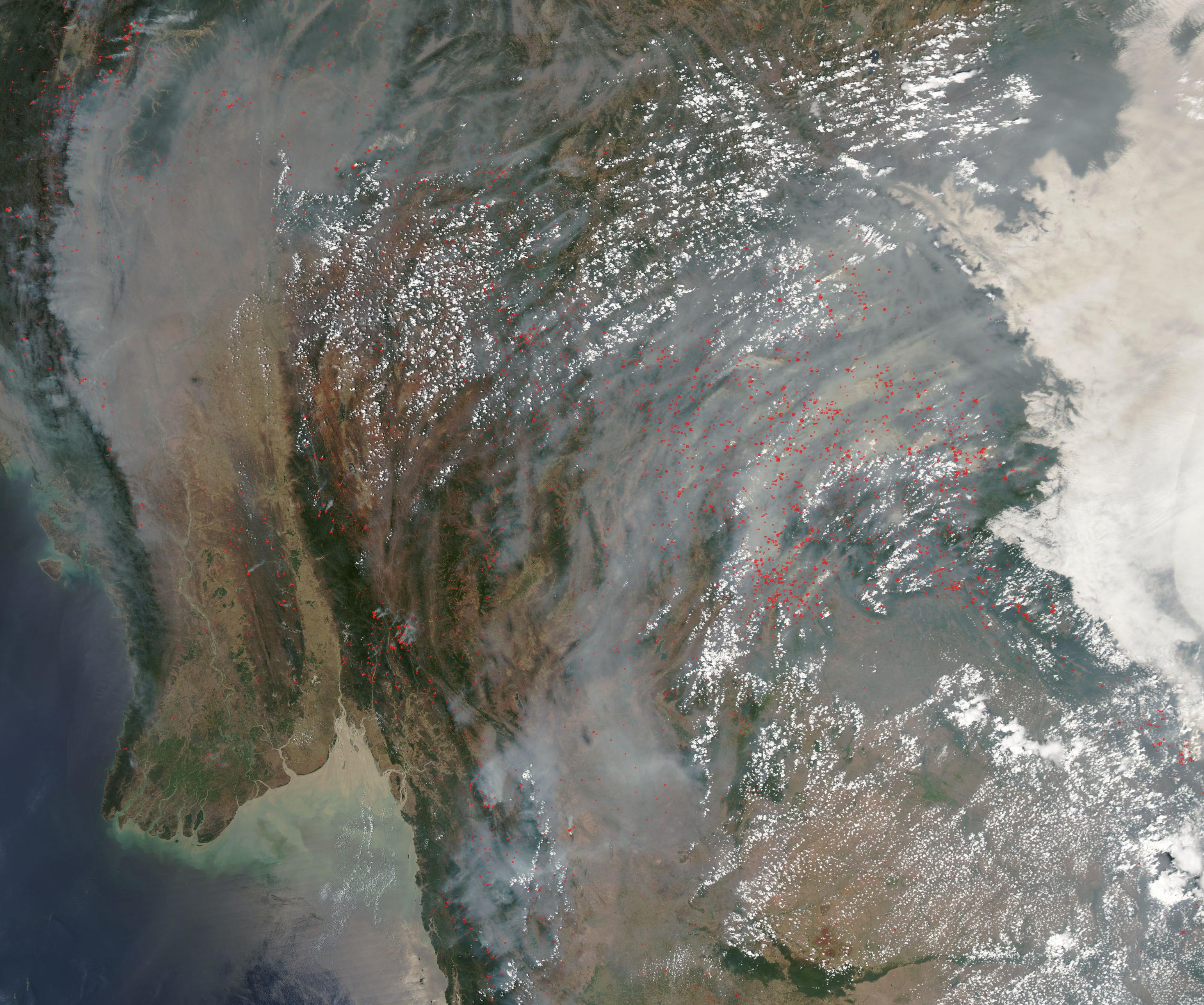
