
Images


November 23, 2020 - Southern Patagonia Icefield
 Tweet
Tweet
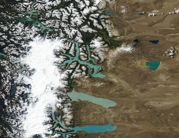
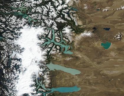
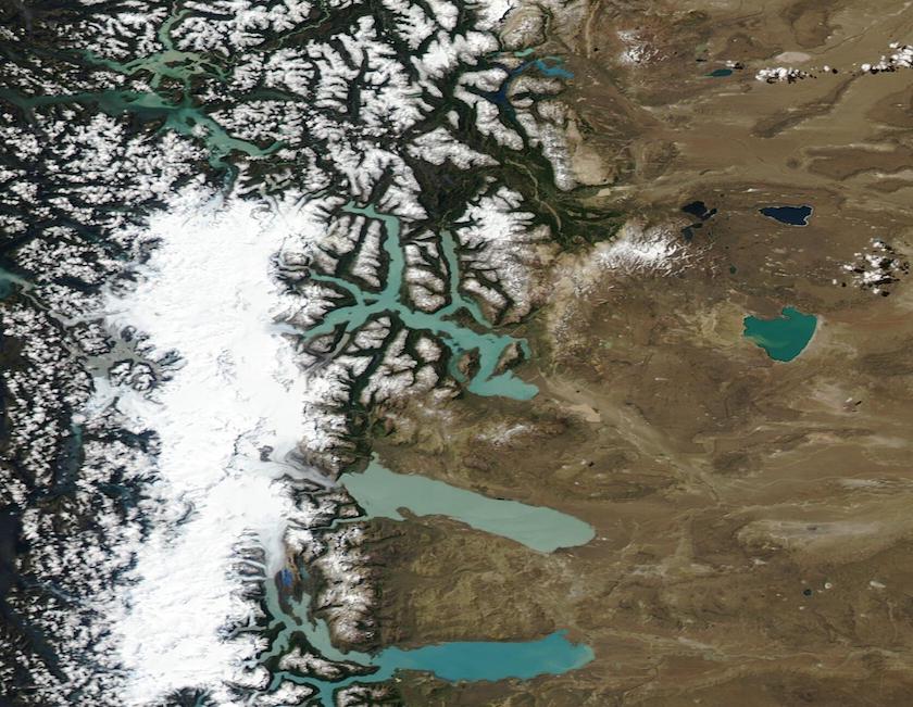
On November 19, 2020, the Moderate Resolution Imaging Spectroradiometer (MODIS) on board NASA’s Aqua satellite acquired a stunning true-color springtime view of the Southern Patagonian Icefield.
This bright white cap of dense, compacted ice sits atop the Andes Mountains year-round, straddling not only the high peaks of the mountains, but also the border between Chile (west) and Argentina (east). The Southern Patagonian Icefield, combined with the Northern Patagonian Icefield, are the remnants of a much larger ice sheet that reached its maximum size about 18,000 years ago. Even though the modern icefields are a mere fraction of the massive, ancient one, they remain the largest expanse of ice in the southern hemisphere outside of Antarctica. But the Patagonian icefields are constantly melting – and the rate of melt has been increasing in recent decades.
As glaciers melt, they release lots of water – enough to create large lakes in low areas found on the high, arid plain east of the Andes. Three lakes that receive meltwater directly from glaciers can be seen in this image. From south to north they are Lago Argentino, Lago Viedma, and Lago San Martin. The round Lago Cardiel receives meltwater through various rivers, especially the Rio Cardiel. Glacial movement slowly pulverizes the rocks below the massive ice sheet into fine-grained sediment. Known as “glacial flour”, these sediments color the water bright turquoise. Each lake’s color is unique and created by a combination of depth and suspended sediment.
Image Facts
Satellite:
Aqua
Date Acquired: 11/19/2020
Resolutions:
1km (38.8 KB), 500m (123 KB), 250m (350.3 KB)
Bands Used: 1,4,3
Image Credit:
MODIS Land Rapid Response Team, NASA GSFC
