
Images


September 13, 2021 - Clouds in the Caucasus Mountains
 Tweet
Tweet
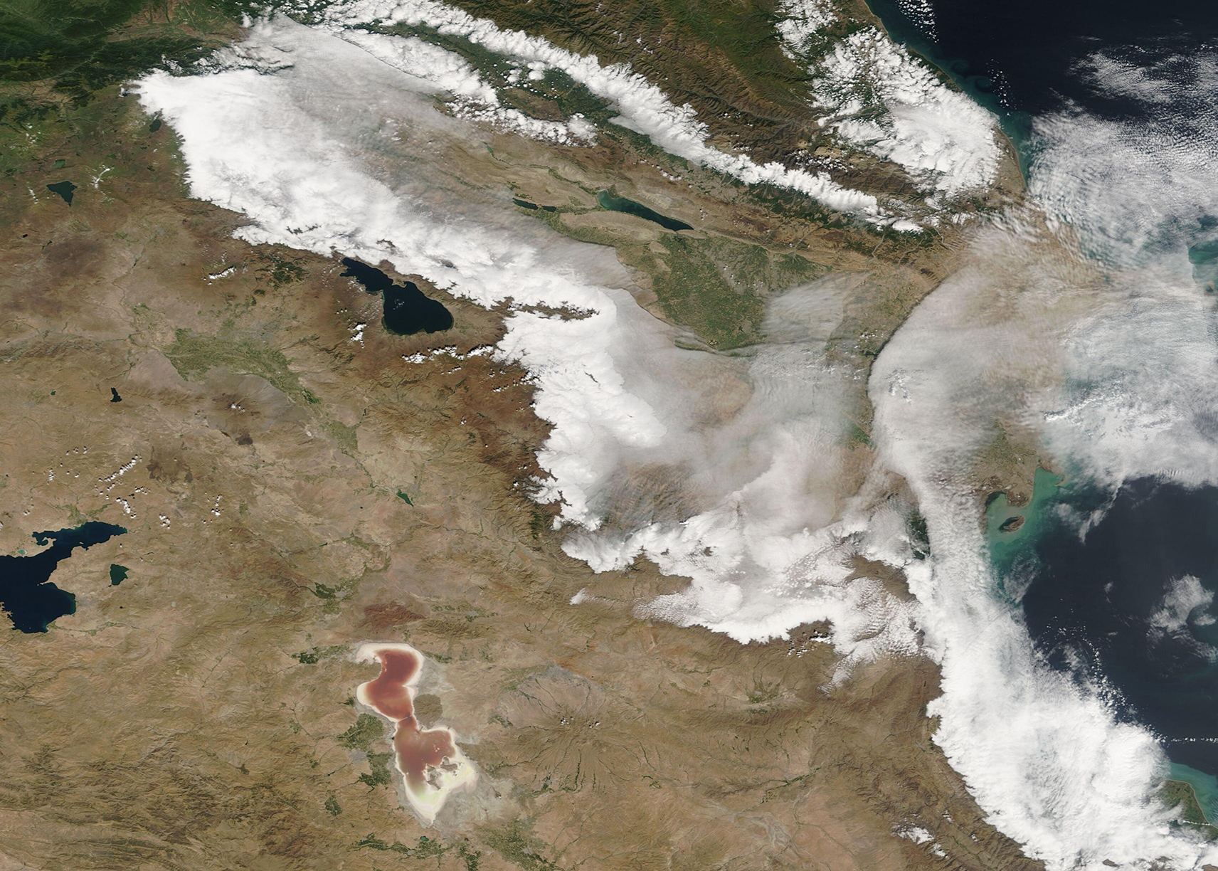
After a week under heavy cloud, sun began to shine over most of the land stretching between the Black Sea and the Caspian Sea on September 9, 2021. The Moderate Resolution Imaging Spectroradiometer (MODIS) on board NASA’s Terra satellite acquired this fascinating true-color image of cloud over the Caucasus Mountain region on that same day.
The Caucasus Mountains for a long (more than 1200 km/746 mi) and steep spine connecting the Black Sea (west) to the Caspian Sea (east). The highest peaks on the Greater Caucasus retain a cap of snow year-round but the more southerly Lesser Caucasus receive less precipitation (and less snow) each year.
In the north of this image, heavy cloud hangs over the southern slopes of the Greater Caucasus. Looking towards the south, a broad bank of cloud also aligns along the northern ridges of the Lesser Caucasus and over the Kura River that runs along the feet of the Lesser Caucasus. This cloud bank thins over areas of lower elevation and across the valley between the mountains, especially in the east and close to the Caspian Sea. Much of these southerly clouds have the fine-grained appearance typical of low cloud (fog). By the next morning, these banks of cloud and fog had dissipated, leaving the region under clear sky.
Image Facts
Satellite:
Terra
Date Acquired: 9/10/2021
Resolutions:
1km (535.3 KB), 500m (1.4 MB), 250m (1 MB)
Bands Used: 9/10/2021
Image Credit:
MODIS Land Rapid Response Team, NASA GSFC
After a week under heavy cloud, sun began to shine over most of the land stretching between the Black Sea and the Caspian Sea on September 9, 2021. The Moderate Resolution Imaging Spectroradiometer (MODIS) on board NASA’s Terra satellite acquired this fascinating true-color image of cloud over the Caucasus Mountain region on that same day. The Caucasus Mountains for a long (more than 1200 km/746 mi) and steep spine connecting the Black Sea (west) to the Caspian Sea (east). The highest peaks on the Greater Caucasus retain a cap of snow year-round but the more southerly Lesser Caucasus receive less precipitation (and less snow) each year.
In the north of this image, heavy cloud hangs over the southern slopes of the Greater Caucasus. Looking towards the south, a broad bank of cloud also aligns along the northern ridges of the Lesser Caucasus and over the Kura River that runs along the feet of the Lesser Caucasus. This cloud bank thins over areas of lower elevation and across the valley between the mountains, especially in the east and close to the Caspian Sea. Much of these southerly clouds have the fine-grained appearance typical of low cloud (fog). By the next morning, these banks of cloud and fog had dissipated, leaving the region under clear sky.
Image Facts
Satellite:
Terra
Date Acquired: 9/10/2021
Resolutions:
1km (535.3 KB), 500m (1.4 MB), 250m (1 MB)
Bands Used: 9/10/2021
Image Credit:
MODIS Land Rapid Response Team, NASA GSFC
