
Images


October 16, 2021 - Fires in Pakistan and India
 Tweet
Tweet
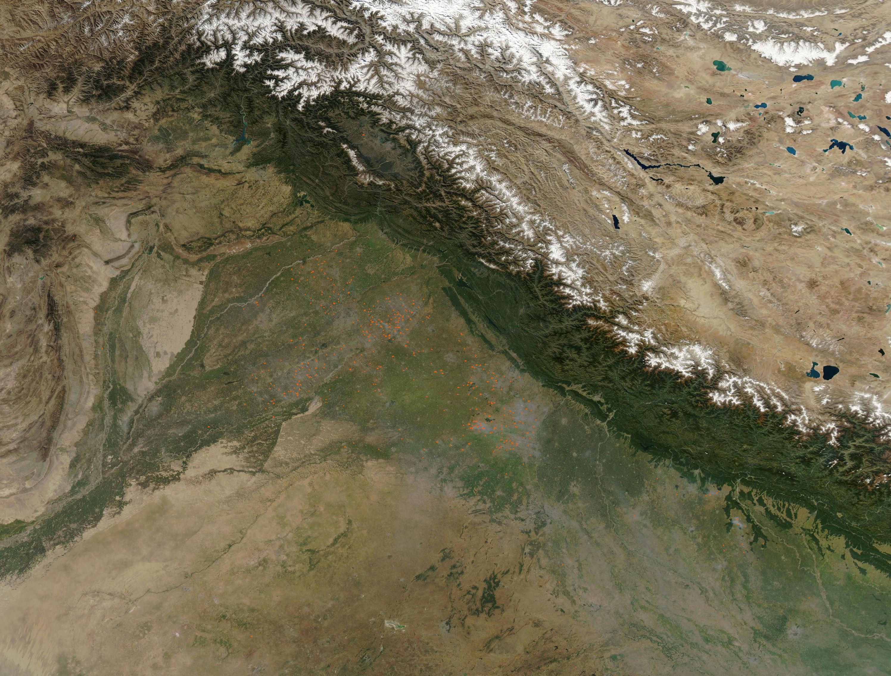
Many dozens of fires speckled the green swath of agricultural land that lies south of the foothills of the Himalaya Mountains in India (east) and Pakistan (west) in mid-October 2021. In this area, the rivers and streams of the region spill out of the mountains to create rich, fertile soil that provides much of the annual harvest for Pakistan and India. Fire is used in traditional agriculture to help clear stubble from fields and preparing soil for new planting.
On October 15, 2021, the Moderate Resolution Imaging Spectroradiometer (MODIS) on board NASA’s Aqua satellite acquired a true-color image of northwestern India and northeastern Pakistan. Each red “hot spot” marks an area where the thermal bands on the instrument detected high temperatures. When combined with typical smoke, as in this image, such hot spots mark actively burning fire. The smoke blows generally toward the southeast, created a light haze south of the snow-capped Himalaya Mountains.
Image Facts
Satellite:
Aqua
Date Acquired: 10/15/2021
Resolutions:
1km (312.1 KB), 500m (1.2 MB), 250m (4 MB)
Bands Used: 1,4,3
Image Credit:
MODIS Land Rapid Response Team, NASA GSFC
