
Images


March 22, 2024 - Tropical Cyclone Neville
 Tweet
Tweet
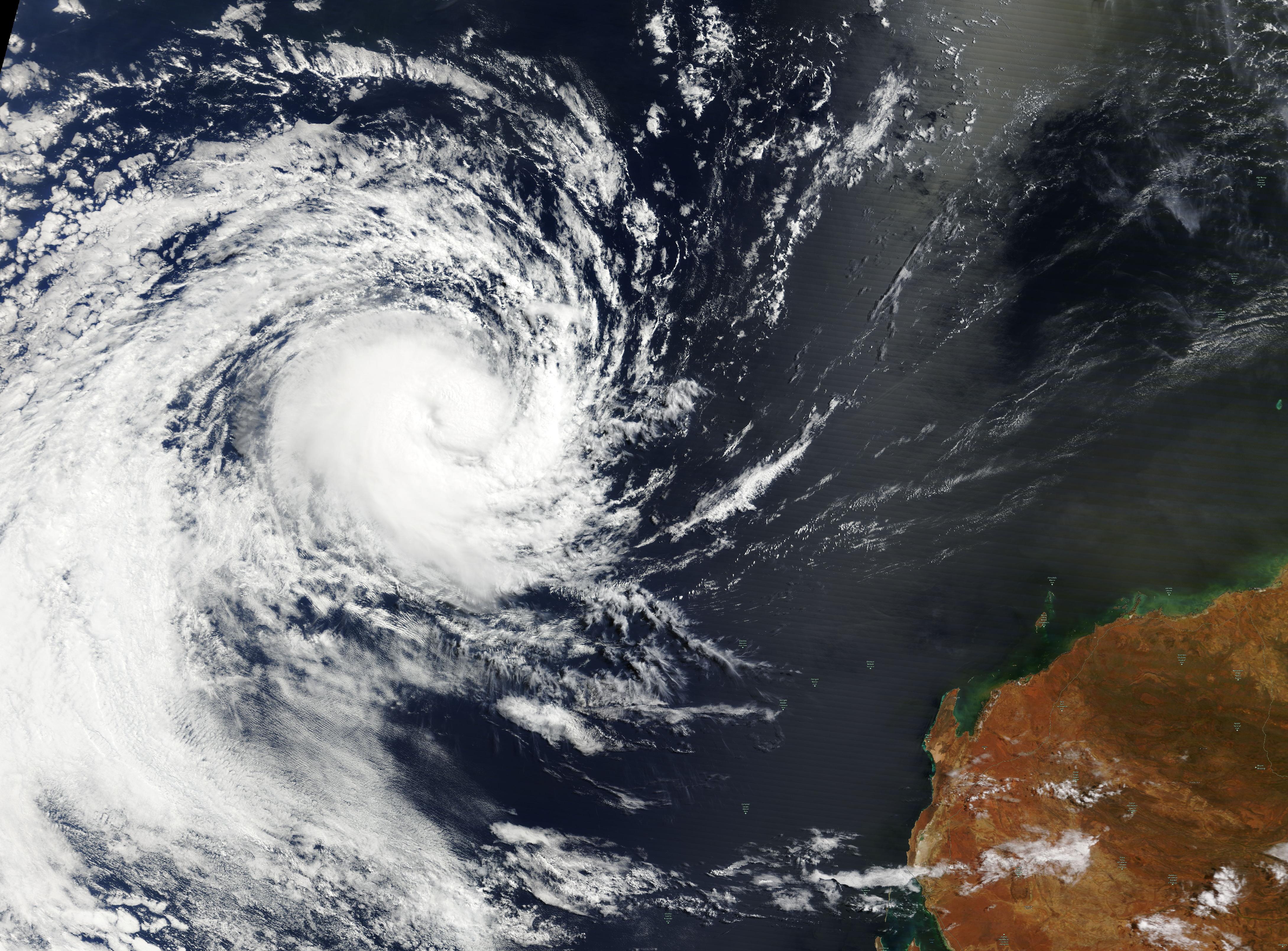
After lingering as a tropical low over the Indian Ocean, Tropical Cyclone Neville became the sixth named tropical cyclone of the 2023-2024 Australian cyclone season on March 20. By the evening of March 21, the storm had strengthened rapidly and was carrying winds of 130 mph (209 km/h). This is equivalent to a Category 4 storm on the Saffir-Simpson Hurricane Wind Scale.
Fortunately, Tropical Cyclone Neville was charting a course away from the Australian mainland and over open ocean. The Joint Typhoon Warning Center (JTWC) forecasts that Neville will continue on a westward track for the next 24 hours, then curve west southwestward. With favorable conditions, the storm may continue to strengthen to peak near 138 mph (254 km/h) over open ocean but should begin to weaken within the next two days, dissipating in 4-5 days.
The Moderate Resolution Imaging Spectroradiometer (MODIS) on NASA’s Terra satellite acquired a true-color image of Tropical Cyclone Neville on March 21. At the time, the asymmetric storm sported a small cloud-filled eye and was circulating northwest of the peninsula known as North West Cape, Western Australia.
Image Facts
Satellite:
Terra
Date Acquired: 3/21/2024
Resolutions:
1km (670.8 KB), 500m (2.1 MB),
Bands Used: 1,4,3
Image Credit:
MODIS Land Rapid Response Team, NASA GSFC
