
Images


September 21, 2024 - The Caribbean
 Tweet
Tweet
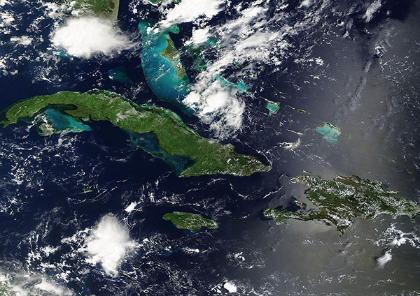
Scattered clouds surrounded several emerald-green Caribbean Islands on September 19, 2024, when the Moderate Resolution Imaging Spectroradiometer (MODIS) on NASA’s Terra satellite acquired this true-color image.
The Caribbean Sea is a tropical arm of the Atlantic Ocean, stretching across about 1,063,000 square miles between the northern coast of South America, eastern Central America, and eastern Mexico. Sprawled across the expanse are more than 700 islands, islets, and cays, which are divided into three major island groups: the Greater Antilles, the Lesser Antilles, and the Leeward Antilles. The Bahamas Archipelago is generally considered to be part of the wider Caribbean region, it is geographically located in the Atlantic Ocean.
Today’s image centers on three of the four largest islands in the Greater Antilles—Cuba, Hispaniola, and Jamaica. Cuba is the largest and longest island and Jamaica, which lies south of the eastern tip of Cuba, looks nearly oval. The island of Hispaniola, covered with “popcorn” cloud in this image, sits near the eastern edge of the image. Hispaniola is divided between two countries: Haiti in the west and the Dominican Republic in the east. Puerto Rico, the fourth island of the Greater Antilles, lies further west and is not captured in this image. In addition, the colorful shallow underwater banks of the Bahamas glitter northeast of Cuba. The tip of the U.S. state of Florida can be seen in the north, shrouded in cloud.
Geologists believe that the Greater Antilles are summits of a mountain chain which has been raised and submerged at different times in the past. The similarity of rock formations found in these islands confirms that they are similar to mountains in Mexico and Central America.
Image Facts
Satellite:
Terra
Date Acquired: 9/19/2024
Resolutions:
1km (713.8 KB), 500m (2.1 MB), 250m (4.7 MB)
Bands Used: 1,4,3
Image Credit:
MODIS Land Rapid Response Team, NASA GSFC
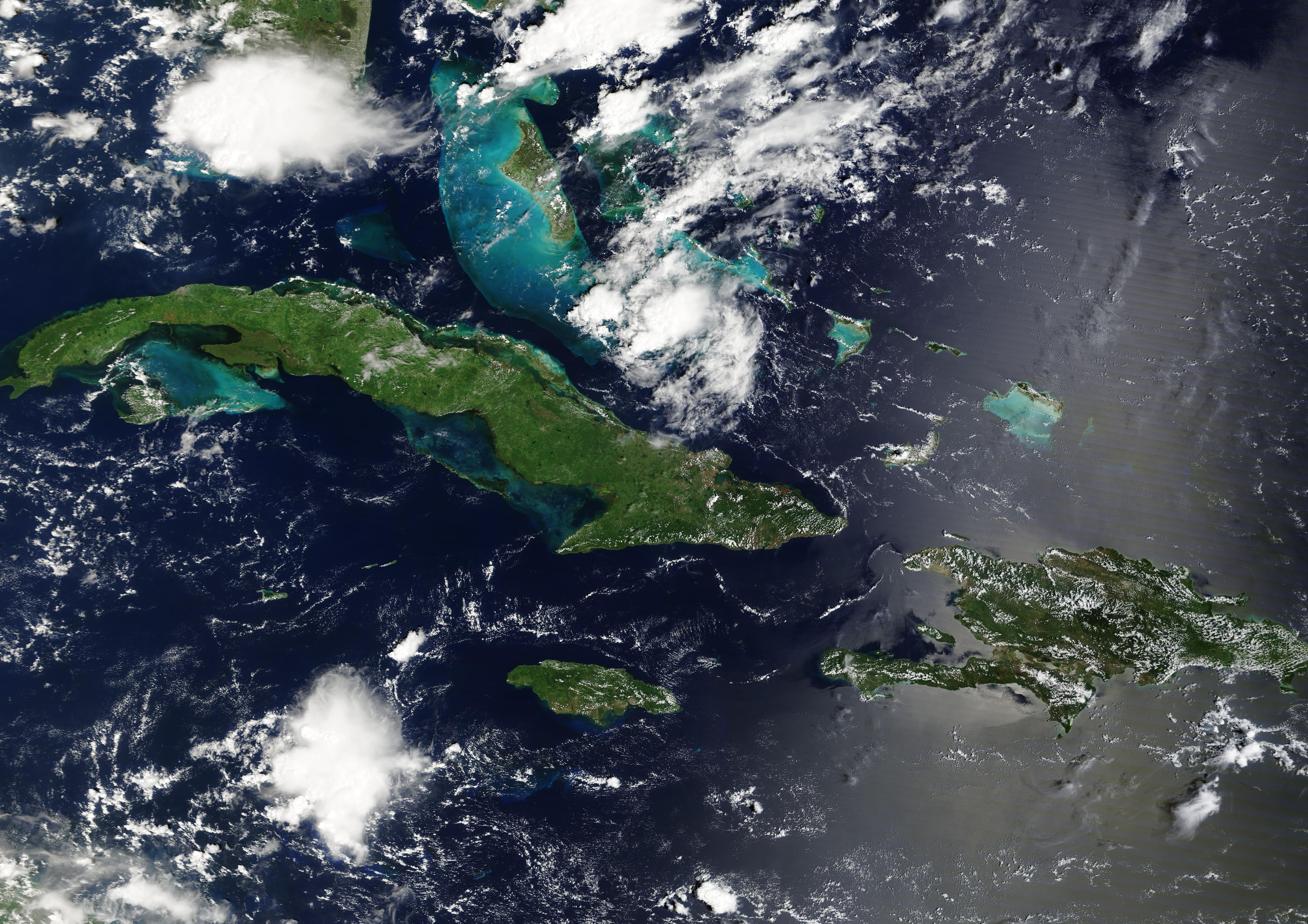
