Images
November 30, 2024 - Ireland
Tweet
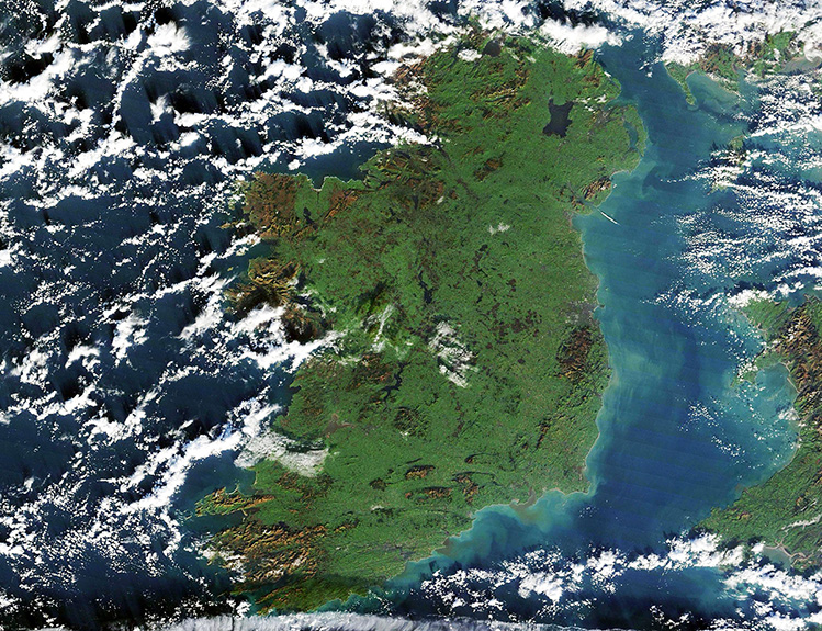
Ireland’s emerald-green color was partially hidden under scattered cloud on November 26, 2024. The Moderate Resolution Imaging Spectroradiometer (MODIS) on NASA’s Terra satellite acquired this true-color image that same day.
The island of Ireland is, politically speaking, divided into two sections: Northern Ireland and the Republic of Ireland. The largest expanse—about five-sixths of the island— belongs to the Republic of Ireland. Northern Ireland, found in the northeastern section of the island, is part of the United Kingdom, along with England, Scotland, and Wales, each of which is located on the island of Great Britain.
Ireland was almost completely covered by glaciers during the ice age, and the topography reflects the grinding presence of slowly moving sheets of ice. A basalt plateau covers much of the northeastern part of the island while the center is covered in lowland which is broken by low hills. This lowland region has been scoured extensively and is covered with glacial deposits of clay and sand. It also contains bog and numerous lakes.
Mountains can be found near the coasts, especially in the east, south, and north. In the south, the mountain ridges are made up of ancient red sandstone, which are separated by limestone valleys. These run along a generally east-west axis. Granite is the dominant mineral in the mountains in the west as well as the more notable mountains in the east.
Image Facts
Satellite:
Terra
Date Acquired: 11/26/2024
Resolutions:
1km (261.9 KB), 500m (823.7 KB), 250m (1.9 MB)
Bands Used: 1,4,3
Image Credit:
MODIS Land Rapid Response Team, NASA GSFC


