
Images


April 15, 2025 - Prescribed Burn in Davy Crockett National Forest
 Tweet
Tweet
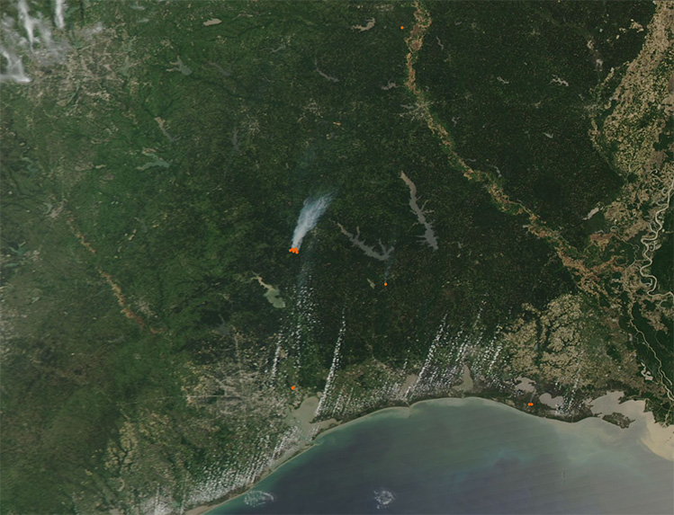
On April 13, 2025, the Moderate Resolution Imaging Spectroradiometer (MODIS) on NASA’s Aqua satellite captured this true-color image of a large new fire burning northeast of Houston. The red “hot spot” marks an area where the thermal bands on the MODIS instrument detected high temperatures. When combined with typical smoke, as in this image, such a signature marks actively burning fire.
This fire was located in the Davy Crockett National Forest, an area which was the subject of a prescribed burn on that date, according to the US Department of Agriculture (USDA) Forest Service. The advice, posted on their website, stated that on April 13, “Officials with the National Forests and Grasslands in Texas, Davy Crockett National Forest, will be conducting a prescribed burn today located in, Compartments 115/116, for a total of 3,659 acres. The burn unit is in Trinity County, in the Alabama Creek WMA between NFSR 531 and HWY 2262.” The operation began at about 10:00 a.m..
Prescribed burns are fires that are deliberately set and contained in order to manage wildland, including grassland and forest. These low-intensity fires reduce dead vegetation, replenish nutrients in the soil, stimulate new growth, and maintain biological diversity.
Prescribed burns are typically performed in late winter and early spring, on days when winds are light. It is essential that vegetation is not too thick or too dry, in order to keep the fire in check.
Image Facts
Satellite:
Aqua
Date Acquired: 4/13/2025
Resolutions:
1km (62.2 KB), 500m (211.4 KB), 250m (606.1 KB)
Bands Used: 1,4,3
Image Credit:
MODIS Land Rapid Response Team, NASA GSFC
