
Images


November 27, 2025 - Fina Strikes The Kimberly
 Tweet
Tweet
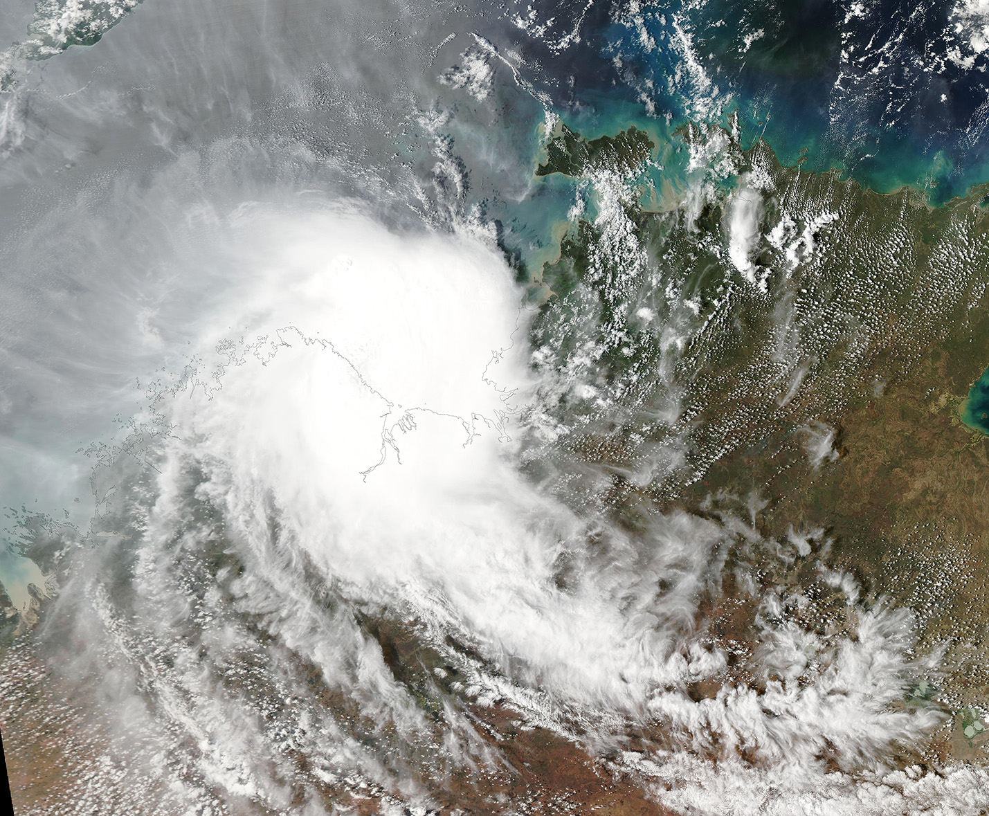
Tropical Cyclone Fina reached peak strength on November 23, 2025, as it tracked southwest through the Timor Sea and Joseph Bonaparte Gulf headed toward the Kimberly, Western Australia. Maximum mean wind speeds were near 165 km/h (102 mph) and gusts reaching 230 km/h (143 mph), placing it as a category 4 storm on the Australian tropical cyclone severity scale.
The compact, but dangerous storm weakened slightly before it made landfall over the Kimberly coast just to the southwest of the Berkley River Mouth on the evening of November 24 as a category 3 storm. Once over land, Fina weakened rapidly although it still carried torrential rain.
The Moderate Resolution Imaging Spectroradiometer (MODIS) on NASA’s Aqua satellite acquired this true-color image of compact Tropical Storm Fina crossing the Kimberly coast on November 24.
This landfall was the second for Tropical Cyclone Fina. The first landfall was on November 21, when the cyclone crossed the Cobourg Peninsula, Northern Territory, as a category 2 storm. Fina brought heavy rain and strong winds, which downed trees and caused widespread power outages, according to media reports.
Image Facts
Satellite:
Aqua
Date Acquired: 11/24/2025
Resolutions:
1km (728.3 KB), 500m (2 MB), 250m (3 MB)
Bands Used: 1,4,3
Image Credit:
MODIS Land Rapid Response Team, NASA GSFC
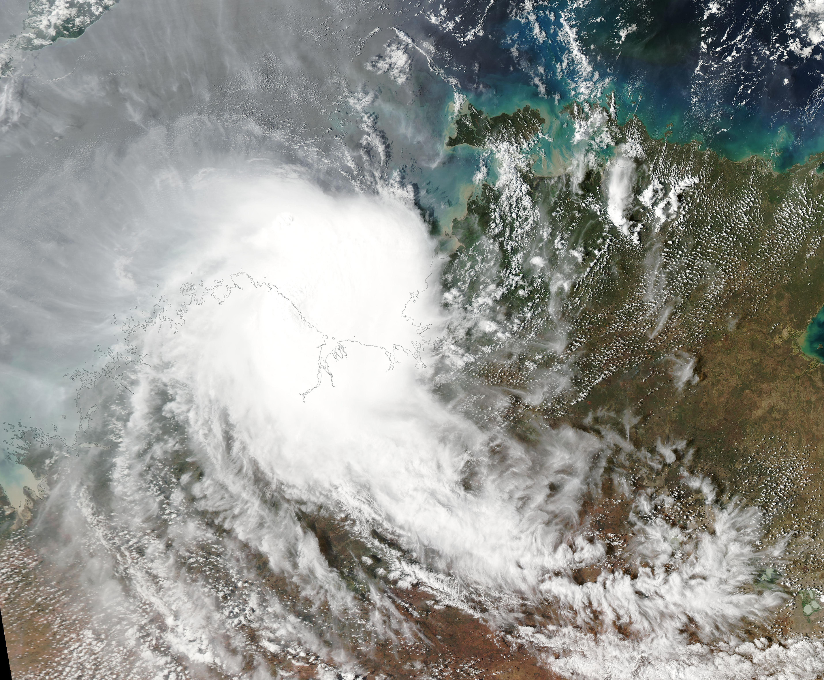
