
Images


February 20, 2015 - Low clouds over Ireland
 Tweet
Tweet
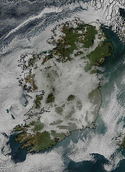
A high pressure system sitting over the North Atlantic Ocean just west of Ireland brought calm winds to the island in early February, 2015. The lack of strong winds, along with a cold winter chill, made conditions ripe for fog to form and linger across the region.
The Moderate Resolution Imaging Spectroradiometer (MODIS) flying aboard NASA’s Terra satellite captured this true-color image of the foggy scene on February 8. Black boundary lines have been overlain on the image to delineate the edges of Ireland. Appearing a bit like a thick spider web, low clouds (fog) spreads across the Emerald Isle, lying thickly over much of the land, especially the valleys and lowlands. Part of the fog bank spills over the coast of southwestern Ireland. Stratocumulus clouds encircle the island, and have a more popcorn-like appearance than the smoother, softer appearance of the fog.
Image Facts
Satellite:
Terra
Date Acquired: 2/8/2015
Resolutions:
1km (85.6 KB), 500m (319.1 KB), 250m (802.7 KB)
Bands Used: 1,4,3
Image Credit:
Jeff Schmaltz, MODIS Land Rapid Response Team, NASA GSFC
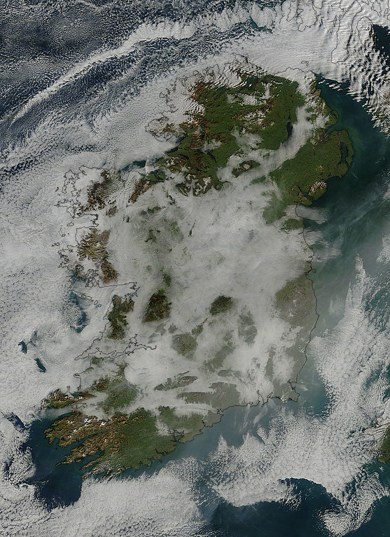
