
Images


February 24, 2015 - Eruption at Bardarbunga, Iceland
 Tweet
Tweet
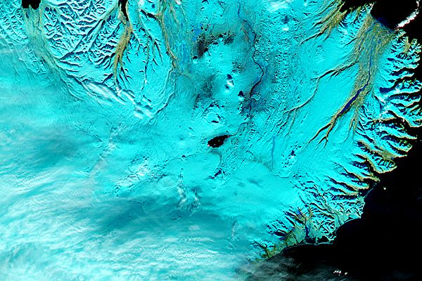
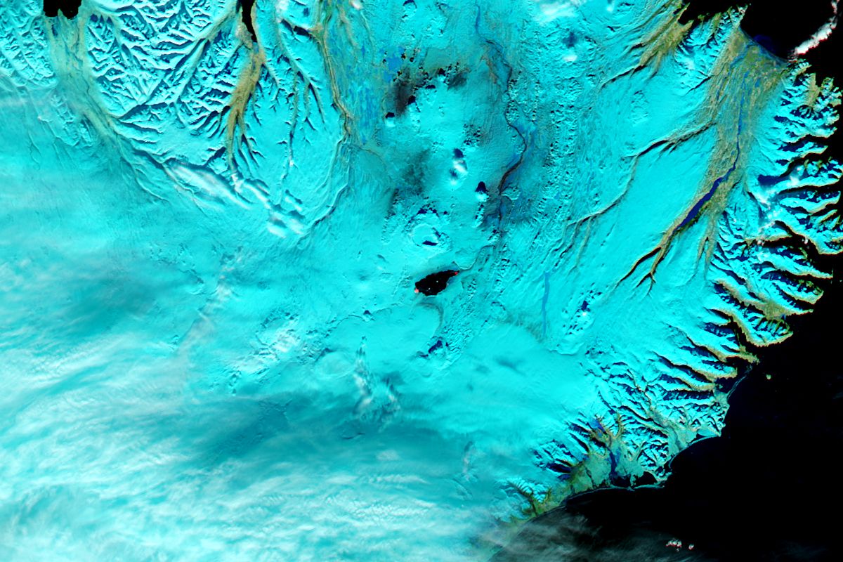
On February 17, 2015, six months and a day after the opening tremors or Bardarbunga’s current eruption were recorded, the Moderate Resolution Imaging Spectroradiometer (MODIS) aboard NASA’s Aqua satellite captured this false-color image of the ongoing event.
The Icelandic Met Office noted a seismic crisis beginning August 16, 2014, with over 1,500 earthquakes swarming within 48 hours. On August 29, 2014 lava began flowing at a fissure at the volcano’s Holuhraun lava field which lies north of the sub-glacial caldera. Several days later, a lava began flowing out of a second fissure in the Holuhraun field.
The hot, liquid lava flowing from the fissures of the Holuhraun field can be seen in this image as two specks of orange, one at the northern end of the almost-oval lava field, and the other one which is larger and brighter at the southern end. The lava field itself appears black, indicating a cooler crust has formed over the lava. The ice surrounding the glacier appears blue in this false-color image, and vegetation appears bright green.
Image Facts
Satellite:
Aqua
Date Acquired: 2/17/2015
Resolutions:
1km (54.5 KB), 500m (83.3 KB), 250m (205 KB)
Bands Used: 7,2,1
Image Credit:
Jeff Schmaltz, MODIS Land Rapid Response Team, NASA GSFC
