
Images


September 4, 2015 - Fires in southern California
 Tweet
Tweet
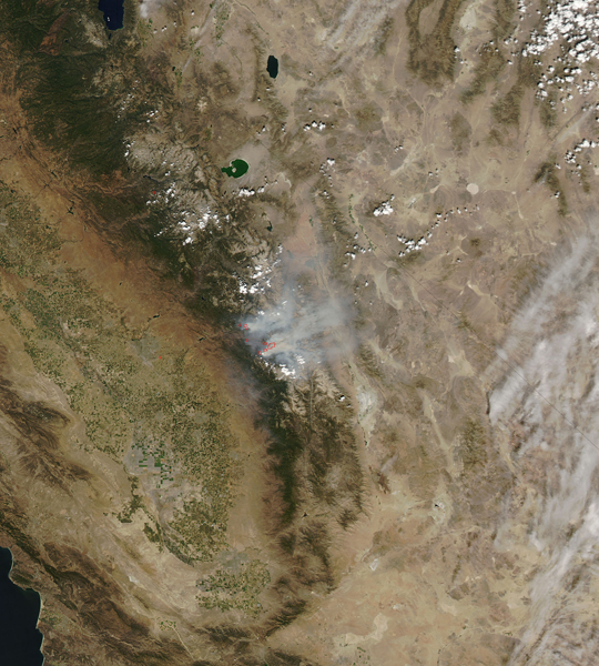
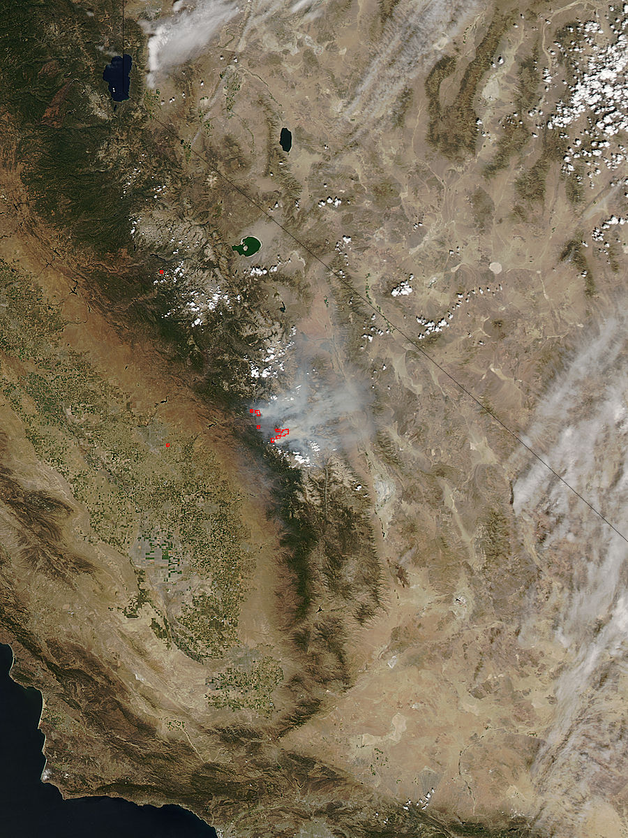
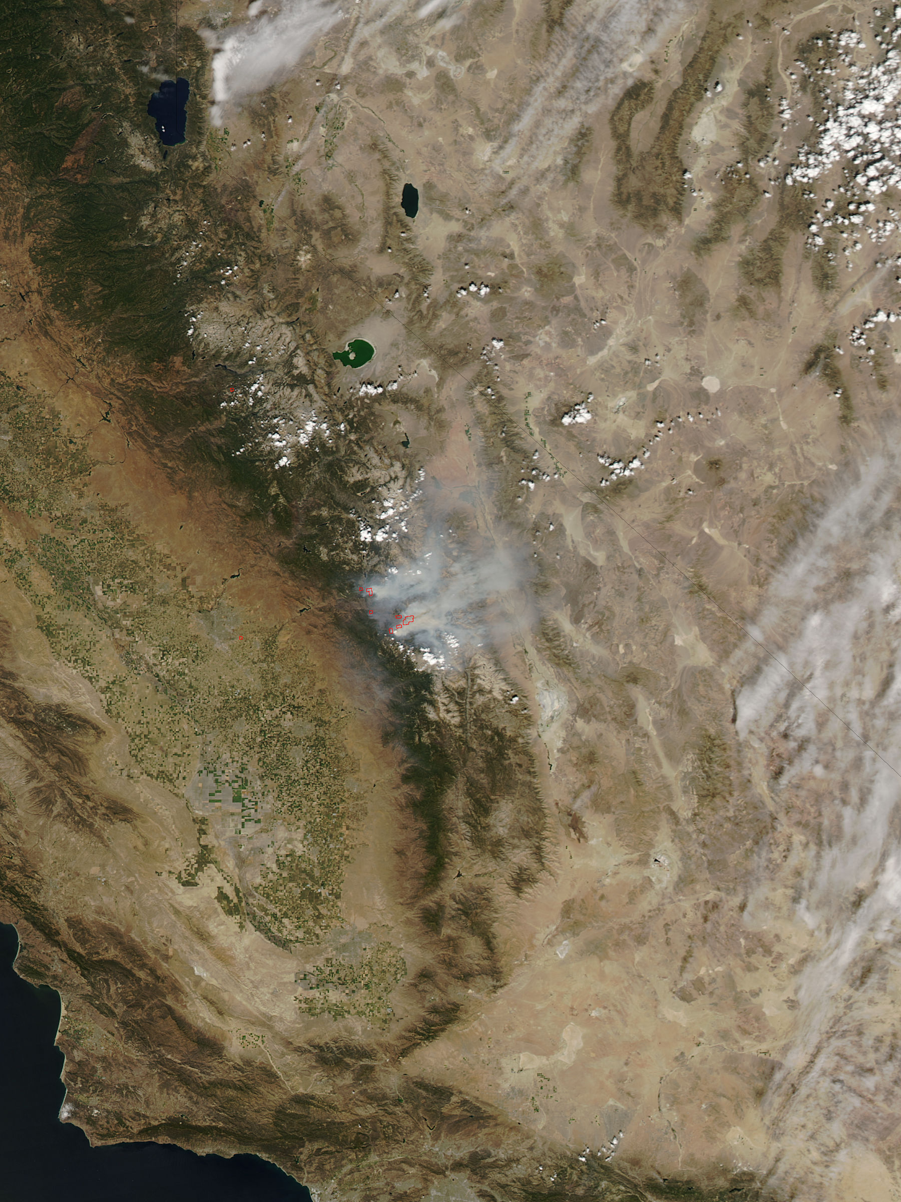
Fires continue to burn across a severely dry California in late August 2015.
The Moderate Resolution Imaging Spectroradiometer (MODIS) aboard NASA’s Aqua satellite captured this true-color image of fires in southern California on August 30. Red hotspots mark areas where the thermal bands on the MODIS instrument detected temperatures substantially higher than background. When accompanied by smoke, they mark actively burning fires.
The largest fire in this image is the Rough Fire, which is currently the largest fire in California. It is burning in timber, chaparral, and tall grass in an area just west of Kings Canyon National Park and north of the town of Hume. As of September 3, Inciweb reports that the Rough Fire has grown to 81,549 acres, with containment at only 25%. 1,901 personnel are currently fighting this fire, which burns near giant sequoia trees and less than two miles away from the community of Cedar Grove.
According to ABC 30 Action News out of Fresno, California, firefighters are working hard to protect important monuments, trees and cabins in the Converse Basin, the Buck Rock area, and Cedar Grove. They report that firefighters use, as a last line of defense, a reflective wrapping material that is made of fiberglass to offer protection against the flames. The wrap has been applied to the Boole Tree, Chicago Stump, and cabins.
Although the fire is burning near important trees, the National Park Service reminds us that “Fire is an essential part of the Sierra forest ecology. Plants and animals have adapted to the periodic, low-intensity fires that naturally occur here. In fact, sequoias need fire to open their cones and release the seeds, and to leave cleared beds of ash where they sprout and grow best".
Image Facts
Satellite:
Aqua
Date Acquired: 8/30/2015
Resolutions:
1km (100.2 KB), 500m (364.3 KB), 250m (883.9 KB)
Bands Used: 1,4,3
Image Credit:
Jeff Schmaltz, MODIS Land Rapid Response Team, NASA GSFC
