
Images


June 22, 2016 - Caspian Sea
 Tweet
Tweet
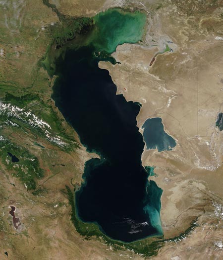
On June 14, 2016, the Moderate Resolution Imaging Spectroradiometer (MODIS) aboard NASA's Terra satellite captured a stunning true-color image of the Caspian Sea on a clear-sky day in late spring.
The Caspian Sea is the world's largest inland sea (measured by surface area), covering about 143,200 square miles (371,000 sq. km). Five countries share the seacoast. Clockwise, from the north, these countries are Russia, Kazakhstan, Turkmenistan, Iran, and Azerbaijan. The Caspian Sea has long been a rich fishery, especially for the economically important sturgeon and its rich caviar. In recent years, however, the fishery has been eclipsed by the potential of oil resources.
The Caspian Sea appears a milky green and blue to the north, close to the green, v-shaped delta of the Volga River. The waters appear darker in the south. This change in appearance is correlated with changes in the depth of the lake and possibly also from sediment and runoff. The northern part of the lake is only 16 to 20 feet deep (5-6 meters) while the depth of the southern end reaches more than 3,300 feet (1,000 meters).
Multiple rivers empty into the Caspian Sea, with the Volga River being the largest. The Caspian Sea has no outlet, so it loses water only by evaporation, which means that salt accumulates in the water. With freshwater inflow in the north, the waters are most saline in the south. Along the eastern perimeter is the Kara-Bogaz-Gol, a nearly circular-shaped, saline inlet which appears light blue from space.
Image Facts
Satellite:
Terra
Date Acquired: 6/14/2016
Resolutions:
1km (407.3 KB), 500m (1.3 MB), 250m (3.2 MB)
Bands Used: 1,4,3
Image Credit:
Jeff Schmaltz, MODIS Land Rapid Response Team, NASA GSFC
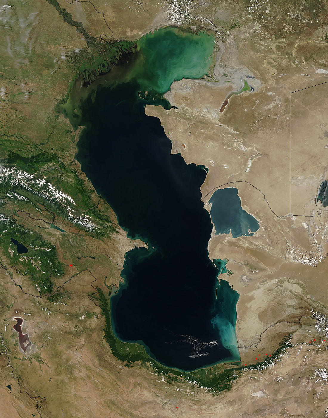
