
Images


May 20, 2018 - Burn Scars in Okavango Delta
 Tweet
Tweet
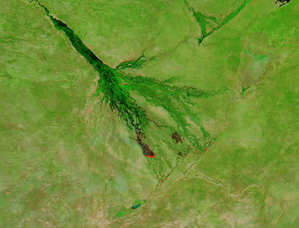
Several fires charred the Okavango Delta, Botswana, in early May 2018. The Moderate Resolution Imaging Spectroradiometer acquired a false-color image of the scene on May 7.
In this image, which uses data from bands 7, 2, and 1, vegetation appears electric green, water appears black, and non-vegetated land appears light brown. Red hot spots mark areas where the thermal bands on the instrument detected high temperatures – in this case, the hot spots mark actively burning fire. Fire burns on the periphery of large chocolate-brown areas. These are burn scars – areas where fire has consumed the vegetation, leaving only charred debris and soil visible.
Image Facts
Satellite:
Aqua
Date Acquired: 5/7/2018
Resolutions:
1km (53.8 KB), 500m (135.8 KB), 250m (241 KB)
Bands Used: 7,2,1
Image Credit:
Jeff Schmaltz, MODIS Land Rapid Response Team, NASA GSFC
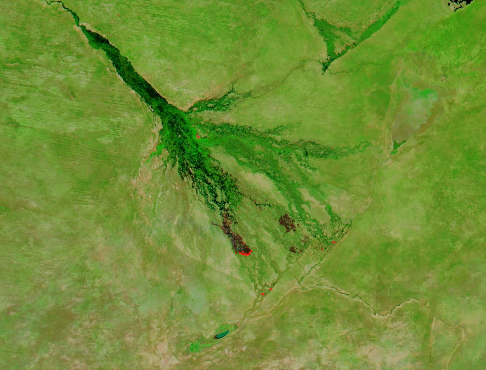
