
Images


October 6, 2018 - Tropical Storm Kong-Rey
 Tweet
Tweet
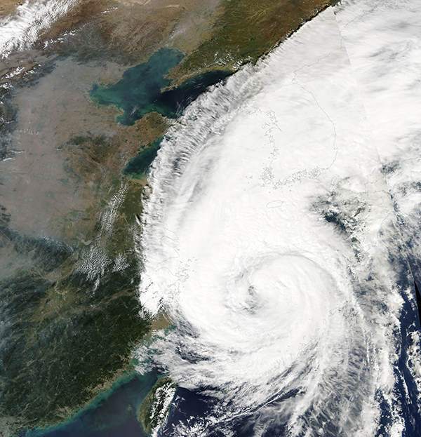
On October 5, 2018, Tropical Storm Kong-Rey was spinning in the South China Sea as it took aim at the Korean Peninsula. The Moderate Resolution Imaging Spectroradiometer (MODIS) aboard NASA’s Terra satellite acquired a true-color image of the very large storm as it brought rain and storm surges to eastern China, Japan, and the Korean Peninsula.
Kong-Rey formed near the Federated States of Micronesia, with the Joint Typhoon Warning Center (JTWC) naming the system as 30W on September 28. As the system moved westward, the storm strengthened and was named Kong-Rey. On September 30, Kong-Rey became a Typhoon and continued to strengthen until reaching Super-Typhoon status on October 2, with maximum sustained winds peaking at 161 mph (259 mph).
Vertical wind shear and cooler sea surface temperatures began to affect Kong-Rey on October 2 and by October 4, Kong-Rey was downgraded to a tropical storm, with maximum sustained winds of about 69 mph (111 km/h).
On October 5, at 11:00 a.m. EDT (1500 UTC), the Joint Typhoon Warning Center reported that Kong-Rey sported maximum sustained winds of about 63 mph (101 km/h) with gusts to 80.5 mph (129.5 km/h). It was located about 237 mi (381.5 km) west-southwest of Sasebo, Japan and was tracking northward at about 22 mph (35 km/h). It was pushing waves with a maximum height of 24 feet (7.3 meters).
Kong-Rey is expected to continue to diminish in strength over the next several days, likely dissipating by October 7. It will continue approaching the Korean Peninsula, likely crossing over Jeju Island and then mainland South Korea on October 6, then northern Japan on October 7.
Image Facts
Satellite:
Aqua
Date Acquired: 10/5/2018
Resolutions:
1km (3.8 MB), 500m (10.4 MB), 250m (8.6 MB)
Bands Used: 1,4,3
Image Credit:
MODIS Land Rapid Response Team, NASA GSFC
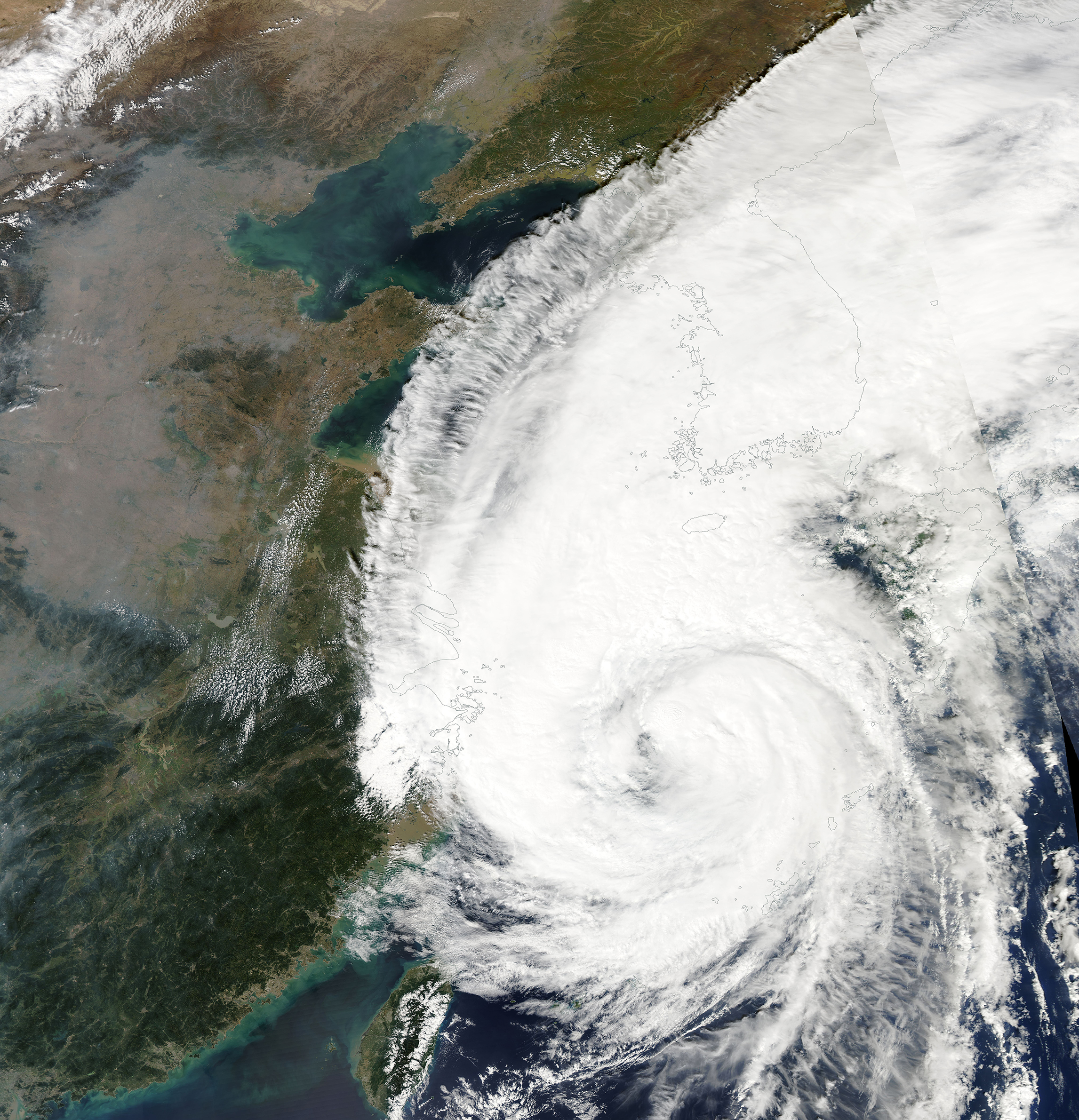
