
Images


October 19, 2018 - Gulf of Mexico
 Tweet
Tweet
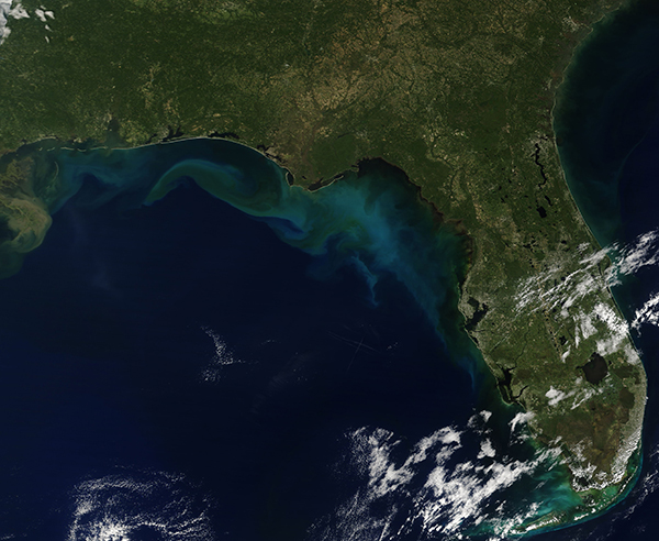
On October 10, 2018, Hurricane Michael struck the Florida Panhandle as a strong Category 4 hurricane with winds roaring at 155 mph (250 km/h). The winds caused significant devastation while rain and storm surge brought inundation and flooding to a wide coastal area. While the after effects of the hurricane were most obvious on land, the view from space confirms that the Gulf of Mexico also felt the wrath of Michael.
On October 13, NASA’s Aqua satellite passed over the Gulf of Mexico, allowing the Moderate Resolution Imaging Spectroradiometer (MODIS) on board to acquire a true-color image three days after the passage of Hurricane Michael. Large tan-and-teal discoloration marks seafloor sediment, river outflows, and coastal sediment washed offshore in the aftermath of Michael’s strong winds, storm surge, and wave action.
A whorl of tan in the west part of the image floats south of Mobile, Alabama and appears to be entirely sediment. Some of the color - especially the milky-blue tones near the west coast of Florida - might also be due to phytoplankton. These are small plant-like microorganisms that live in the region year-round in small quantities and bloom in spectacular fashion when conditions are right.
Image Facts
Satellite:
Terra
Date Acquired: 10/13/2018
Resolutions:
1km (748 KB), 500m (1.8 MB), 250m (1.5 MB)
Bands Used: 1,4,3
Image Credit:
MODIS Land Rapid Response Team, NASA GSFC
