
Images


January 14, 2019 - Haze over India
 Tweet
Tweet
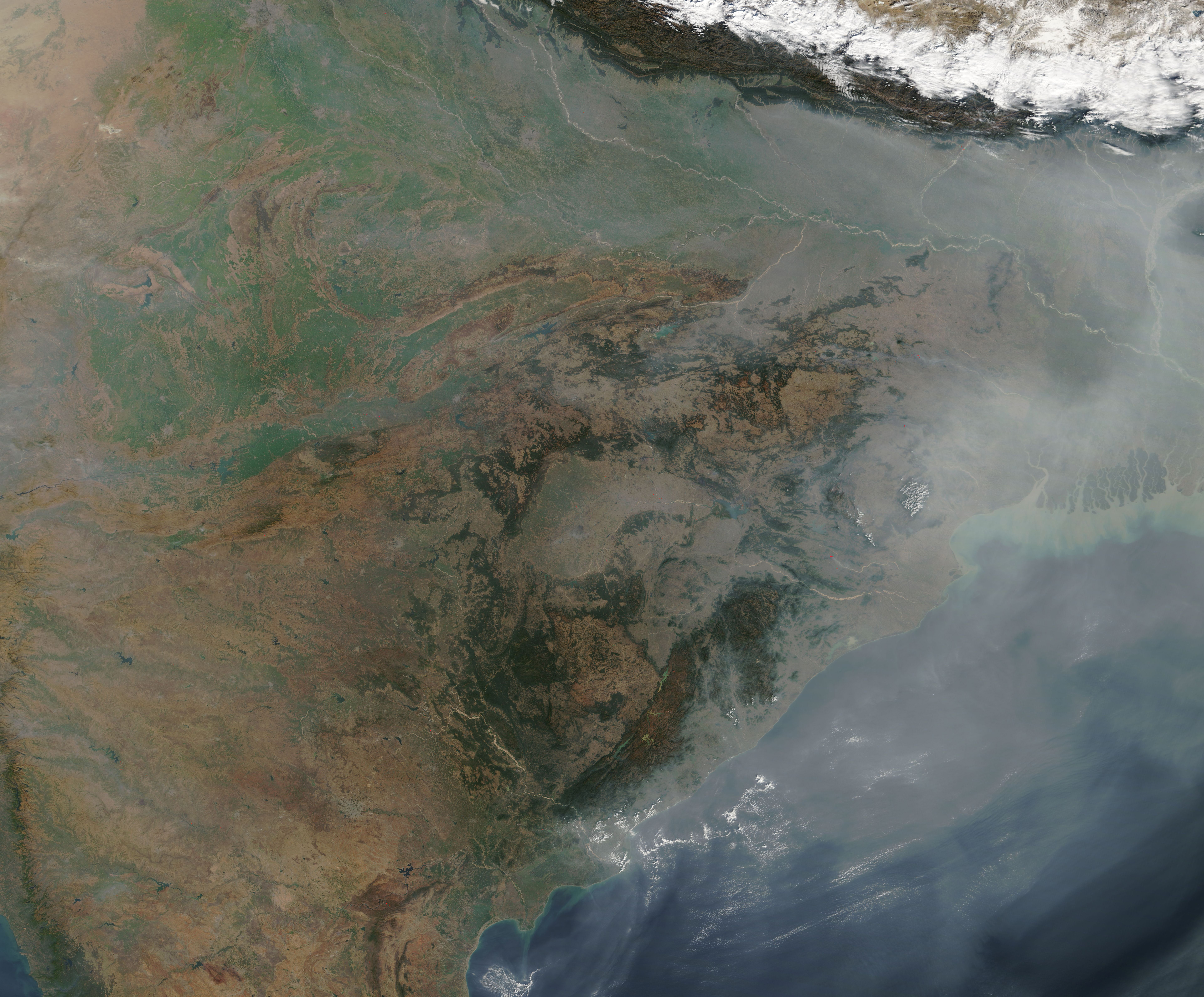
A hazy pall hung over India in early January 2019. The Moderate Resolution Imaging Spectroradiometer (MODIS) on NASA’s Terra satellite acquired a true-color image of the scene on January 9.
Winter haze has become common in northern India and in Bangladesh, especially during the winter. The haze season starts in late fall, when farmers in northwestern India set controlled fires to burn away stubble from harvested crop and to prepare land for planting. The smoke from those fires tend cover the plains south of the Himalayas and drift to the east. As winter progresses, coal-fired plants, biomass burning for heat and cooking (wood, straw, and dung), and exhaust from vehicles add to the haze, especially in the northeast.
Winter is also prime-time for temperature inversions in this region. Air high in the atmosphere is usually cooler than the air closer to the surface. As warm air rises in the atmosphere, any pollutants acquired close to the surface tend to disperse. During winter, cold air often slides down the southern layer face of the Himalayas, getting trapped under a layer of warmer air. The warmer air acts as a cap, keeping the cooler air from rising. As long as the cold air stays below the warmer layer, the inversion holds the pollutants close to the surface.
Image Facts
Satellite:
Terra
Date Acquired: 1/9/2019
Resolutions:
1km (2.1 MB), 500m (6.2 MB), 250m (5.3 MB)
Bands Used: 1,4,3
Image Credit:
MODIS Land Rapid Response Team, NASA GSFC
