
Images


March 13, 2019 - Tropical Cyclone Idai
 Tweet
Tweet
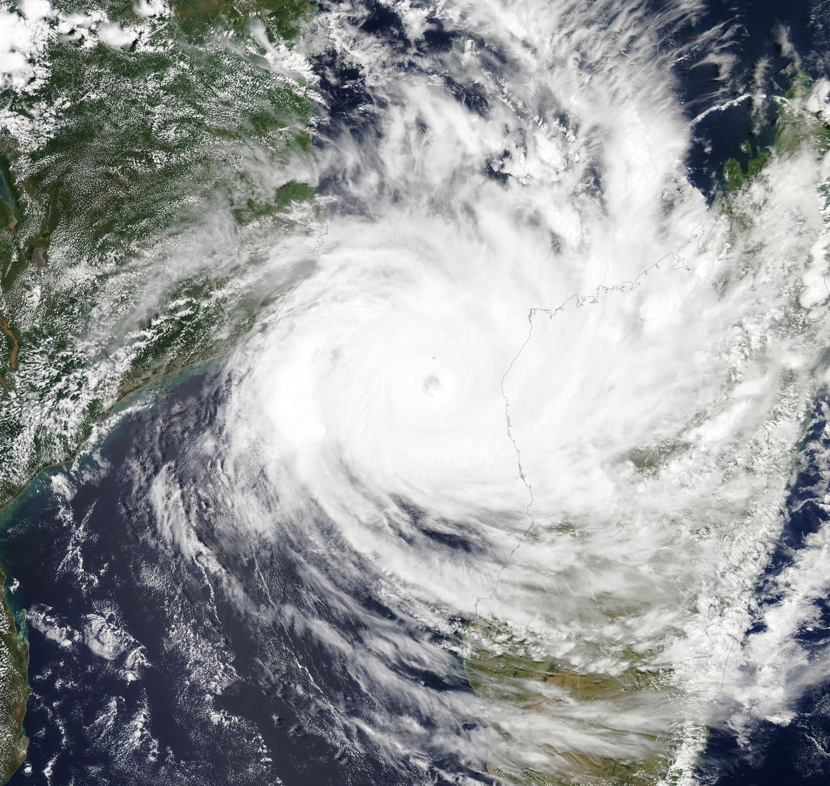
On March 11, 2019, the Moderate Resolution Imaging Spectroradiometer (MODIS) on board NASA’s Aqua satellite captured a true-color image of Tropical Cyclone Idai in the Mozambique Channel, Southern Indian Ocean.
Mozambique is located on the African mainland (left) and Madagascar (right) is the island nation. The Mozambique Channel is the body of water in the Southern Indian Ocean that flows between Mozambique on the African mainland and the island nation of Madagascar.
At the time the image was acquired, bands of powerful thunderstorms were wrapping around a central eye which was obscured by high clouds. The eye appears to be about 17 nautical miles (19.6 mi/31.5 km) wide. The eastern quadrant of the powerful storm was affecting west-central Mozambique.
Tropical Cyclone Idai developed on March 9 around 4 a.m. EST (0900 UTC). It developed from the low pressure area designated System 98S. When it strengthened into a depression, it was renamed Tropical Cyclone 18S. After strengthening into a tropical storm on March 10, it was renamed Idai.
On March 11 at 11 a.m. EDT (1500 UTC), Idai was located near 17.6 degrees south latitude and 42.6 degrees east longitude. That’s about 307 miles north-northeast of Europa Island. Idai was moving to the southwest and had maximum sustained winds 105 knots (121 mph/194.5 kph). It was generating maximum wave heights near 27 feet (8.2 meters).
The Joint Typhoon Warning Center expects Idai to intensify further as it moves west. Idai’s sustained winds are expected to peak at a Category 4 hurricane strength (on the Saffir-Simpson hurricane wind scale) with 125 knots (144 mph/231.5 km/h) before making landfall near Beira, Mozambique after March 15.
Image Facts
Satellite:
Aqua
Date Acquired: 3/11/2019
Resolutions:
1km (504.7 KB), 500m (1.5 MB), 250m (4.8 MB)
Bands Used: 1,4,3
Image Credit:
MODIS Land Rapid Response Team, NASA GSFC
