
Images


May 18, 2019 - Iraq, Iran, Kuwait, and the Persian Gulf
 Tweet
Tweet
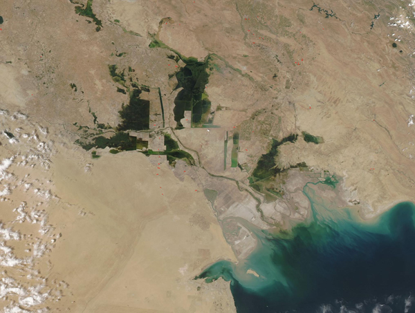
Sediment poured into the Persian Gulf when the Moderate Resolution Imaging Spectroradiometer (MODIS) on board NASA’s Aqua satellite acquired a true-color image of Iraq, Iran, Kuwait and the northern Persian Gulf on May 17, 2019.
Most of the sediment is coming from the Shatt al Arab River, which enters the Gulf along the Iran-Iraq border. The river drains the combined waters of the Euphrates and Tigris Rivers of Iraq and the Karun River of Iran. As sediment washes into the blue waters, it turns water tan and then green and then finally blue as it disperses. Some of the color may also be sediment churned up from the shallow bed along the northern shores.
Iraq lies to the west of the Shatt al Arab River and Iran lies to the east. Iraq owns only about 36 miles (58 km) along the Persian Gulf. Kuwait sits on the coast to the west of Iraq. The large green areas are flood plains and marshes which fill with water as spring rains and snow melt send increased flow into the region. While moderate spring flooding is part of the cycle of life, heavy rains in March and April 2019 caused unusually heavy and destructive flooding. In Iran alone, this year’s floods killed at least 60 people and caused hundreds of millions of dollars in damages and lost crops.
Image Facts
Satellite:
Aqua
Date Acquired: 5/17/2019
Resolutions:
1km (164.8 KB), 500m (450.2 KB), 250m (785.5 KB)
Bands Used: 1,4,3
Image Credit:
MODIS Land Rapid Response Team, NASA GSFC
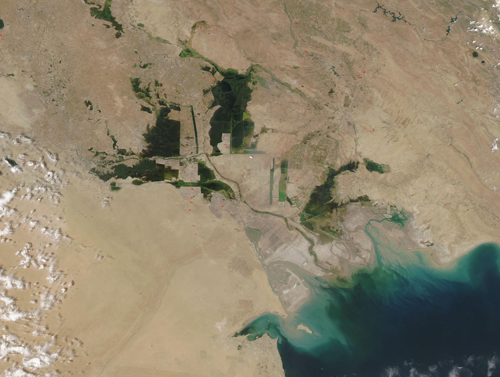
