
Images


May 20, 2019 - Thawing Ice on the Lakes of Saskatchewan
 Tweet
Tweet
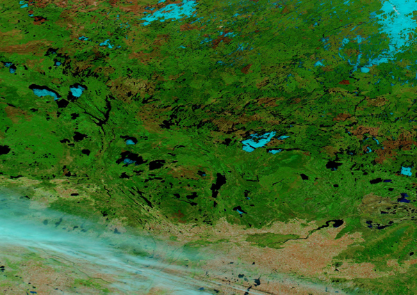
On May 17, 2019, the Moderate Resolution Imaging Spectroradiometer (MODIS) on board NASA’s Aqua satellite acquired a false-color image of central Saskatchewan, Canada. Using infrared as well as visible light (bands 7,2,1), this image shows vegetation as bright green, water as black or dark blue, bare soil as sandy pink, ice as electric blue, cloud as white or white tinted with electric blue, and burn scars as red to rusty reddish-brown.
Boreal forest covers most of this image, and the various shades of green suggests different types of vegetation. Patches of red, rust, and rusty green may also represent shades of vegetation, but more likely represent burn scars. After a large, hot, fire, vegetation can be completely burned away, leaving a charred mark called a burn scar. As vegetation slowly reclaims the charred area, the color seen from space changes until, after many years, the burned area appears very similar to natural forest. A number of burn scars, from relatively fresh to several years old, appear to be scattered in the lush greens of the boreal forest.
Large patches of snow lie over the northern boreal forest, suggesting winter’s icy cold continues. However, most of central Saskatchewan shows signs of spring warming as the ice melts on the many lakes in the region. Warmth has been persistent enough that ice remains only on a few large, deep lakes. Most of the lakes, especially the southerly ones, appear entirely ice-free. In the south, the boreal forest gives way to plains, which appear light sandy-pink. These plains are extensively agricultural, and in early spring the crops have not yet begun to grow.
Image Facts
Satellite:
Aqua
Date Acquired: 5/16/2019
Resolutions:
1km (759.1 KB), 500m (1.8 MB), 250m (4.5 MB)
Bands Used: 7,2,1
Image Credit:
MODIS Land Rapid Response Team, NASA GSFC
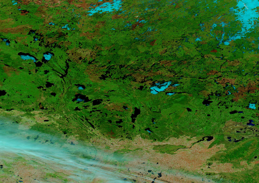
