
Images


February 14, 2015 - Typhoon Higos (02W) in the South Pacific Ocean
 Tweet
Tweet
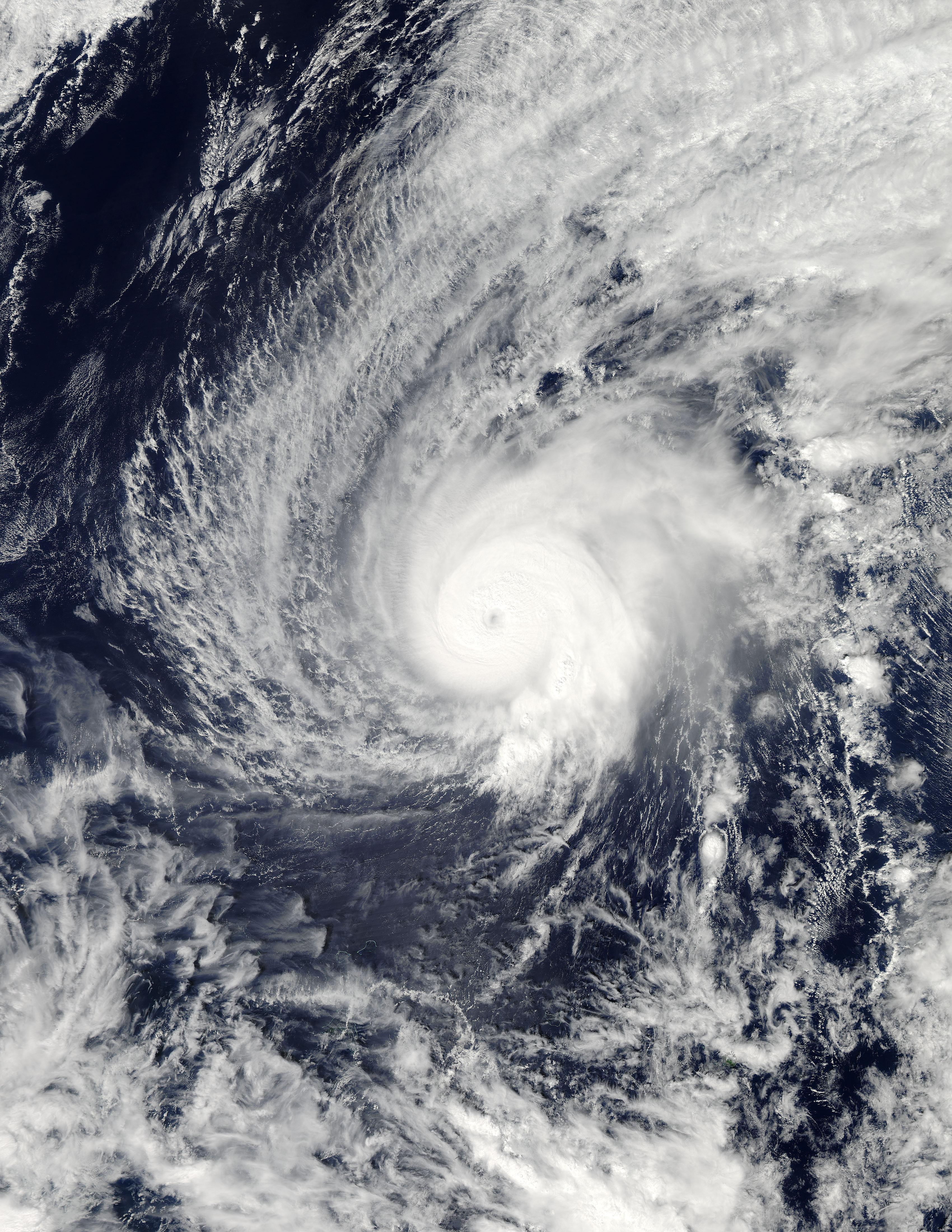
On February 7, 2015, the Joint Typhoon Warning Center reported that Tropical Storm 02W (Higos) had formed in the northwest Pacific Ocean. After spending the better part of two days as a tropical storm, Higos intensified. Late on February 8, Typhoon Higos reached minimal Category 1 status on the Saffir-Simpson Hurricane Wind Scale, with wind speeds of 75 mph (121 km/h). On February 10, Typhoon Higos’ peak winds were reported at 121 mph (195 km/h), or Category 3 strength. However, some evidence exists that the winds may briefly have reached higher into Category 4 strength. Even as a Category 3 Typhoon, however, Higos made the record books as the strongest tropical cyclone on record for so early in the year in the Northern Hemisphere.
On February 10, 2015 at 03:10 UTC (Feb. 9 at 10:10 p.m. EST) the Moderate Resolution Imaging Spectroradiometer (MODIS) instrument aboard NASA's Aqua satellite captured a true-color image of Tropical Cyclone Higos as its eye was filling in with clouds. Later in the day, at 1500 UTC (10 a.m. EST), Higos was still a typhoon centered near 14.7 north latitude and 154.1 east longitude, about 519 miles (835 km) north-northeast of Chuuk. Higos was moving to the north at about 6 mph/10 km/h). At that time, the Joint Typhoon Warning Center (JTWC) noted that animated enhanced infrared satellite imagery showed that Higos had started to weaken, and that the eye feature had dissipated. In addition, deep (strong) convection (rapidly rising air that forms the thunderstorms that make up a tropical cyclone) had become less organized.
On Feb. 11 at 1500 UTC (10 a.m. EST), the Joint Typhoon Warning Center (JTWC) issued the final warning on Higos. At that time the storm had weakened from a typhoon to a depression with maximum sustained winds near 29 mph (46 km/h). It was centered near 16.0 north latitude and 152.4 east longitude, about 525 miles (845 km) east-northeast of Andersen Air Force Base, Guam. It was moving to the northwest at about 7 mph (11 km/h).
The last update from JTWC noted that Higos was being battered by strong vertical wind shear. Higos was no threat to land areas and was dissipating under hostile atmospheric conditions.
Image Facts
Satellite:
Date Acquired: 2/10/2015
Resolutions:
1km (1.1 MB), 500m (3.5 MB), 250m (8.2 MB)
Bands Used: 1,4,3
Image Credit:
Jeff Schmaltz, MODIS Land Rapid Response Team, NASA GSFC
