
Images


February 29, 2016 - Wave clouds in the Great Australian Bight
 Tweet
Tweet
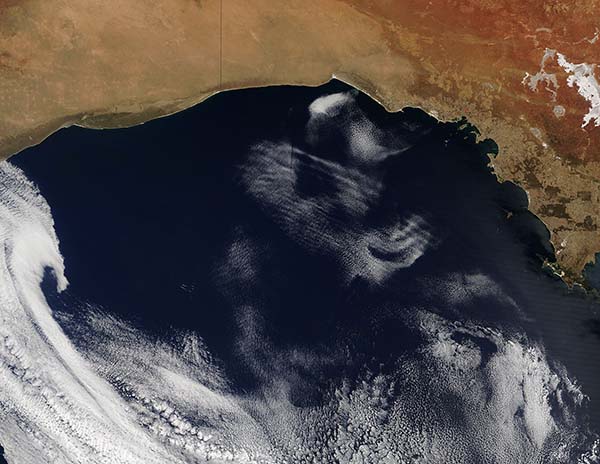
On February 12, 2016, the Moderate Resolution Imaging Spectroradiometer (MODIS) aboard NASA’s Terra satellite acquired a striking true-color image of wave clouds over the Great Australian Bight.
The parallel lines of clouds, which resemble waves rolling in an ocean, are formed by movement of the atmosphere. Waves can form in the atmosphere for a number of reasons. Frequently, air moving over a topographic feature - such as a tall mountain ridge – will force air to rise or sink, and this movement can be propagated forward as waves. Clouds form at the peak of the wave and when the air sinks again the clouds dissipate, creating a pattern of parallel rows as seen in this image.
Another reason for wave cloud formation, especially over the Great Australian Bight, are cold fronts passing over the land. Ahead of a cold front the low-level flow can advect the hot continental air off shore. As the hot, dry air flows over the much cooler waters of the Bight, a strongly stable stratified internal boundary layer forms over the water. These conditions are favorable for the creation and the propagation of atmospheric waves. Not common at any time of the year, wave clouds formed by cold fronts are almost always seen in the summer in this region.
Image Facts
Satellite:
Terra
Date Acquired: 2/12/2016
Resolutions:
1km (263.1 KB), 500m (1023.8 KB), 250m (2.5 MB)
Bands Used: 1,4,3
Image Credit:
Jeff Schmaltz, MODIS Land Rapid Response Team, NASA GSFC
