
Images


June 6, 2016 - Newfoundland
 Tweet
Tweet
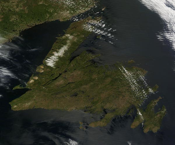
The rugged island of Newfoundland lies on the northeastern edge of North America at the mouth of the St. Lawrence River. Covering about 111,390 square kilometers (43,008 sq. mi.), the island is nearly the size of the Canadian provinces of Nova Scotia, New Brunswick and Prince Edward combined.
Newfoundland's landscape is rich and dramatic, with dark green boreal forests growing inland while rocky coastlines and fjords cut away at the edges. The island can be divided into three regions: the Newfoundland Highlands, the Atlantic Upland and the Central Lowlands. The Highlands lie on the western part of the island. This rugged region is home to mountains rising to 814 m (2,671 ft). The rolling plateau known as the Atlantic Upland sits in the south and east. Many bogs, ponds, and small lakes fill this region although the landscape on the Avalon Peninsula, in the southeast, becomes rugged. The Central Lowland is flat or gently rolling and occupies the north central section of Newfoundland.
The Moderate Resolution Imaging Spectroradiometer (MODIS) aboard NASA's Terra satellite captured a true-color image of Newfoundland on June 2, 2016. The Long Range Mountains remained covered with a blanket of snow on this late-spring day.
Image Facts
Satellite:
Terra
Date Acquired: 6/2/2016
Resolutions:
1km (98.3 KB), 500m (255.8 KB), 250m (848.9 KB)
Bands Used: 1,4,3
Image Credit:
Jeff Schmaltz, MODIS Land Rapid Response Team, NASA GSFC
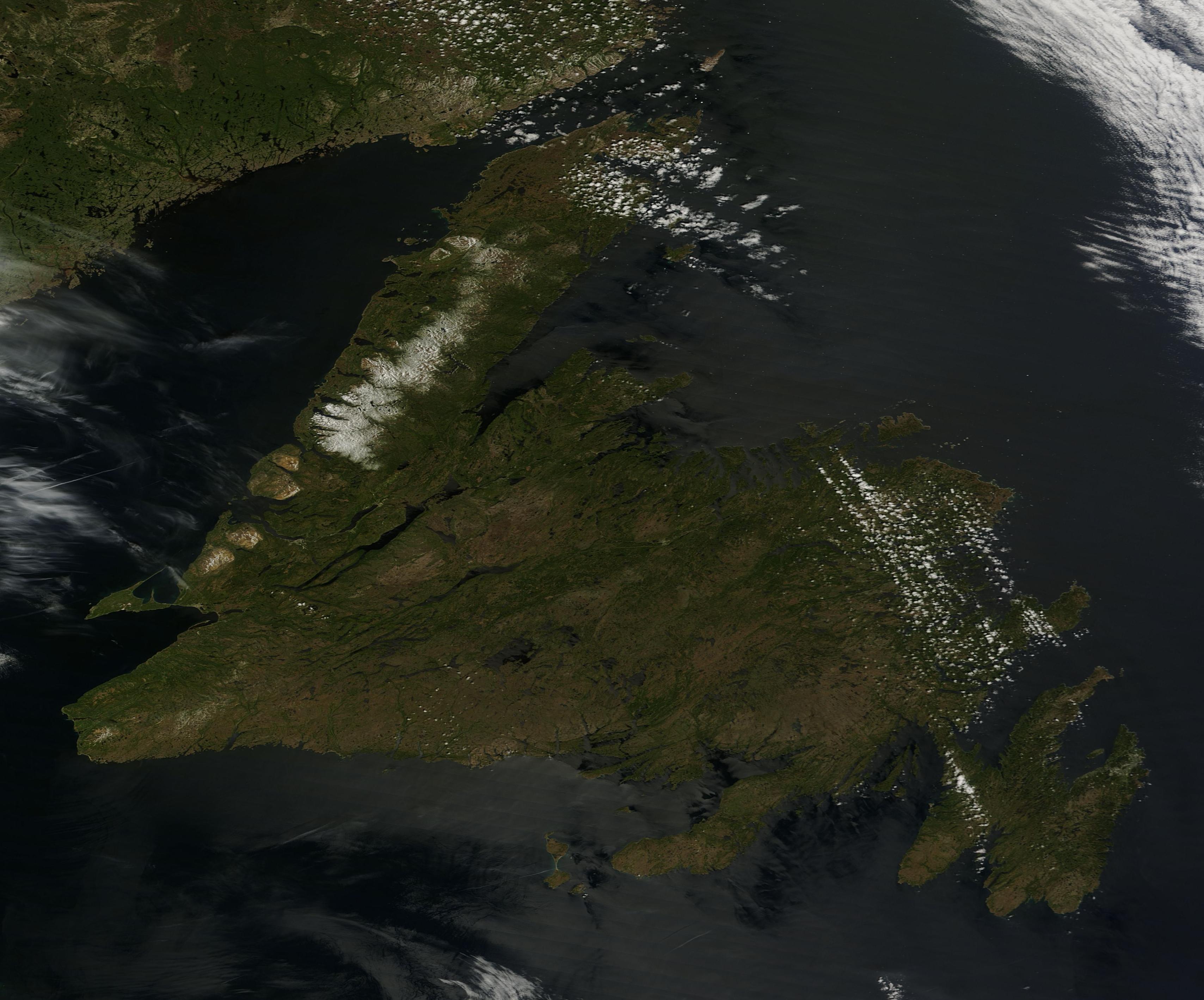
