Images
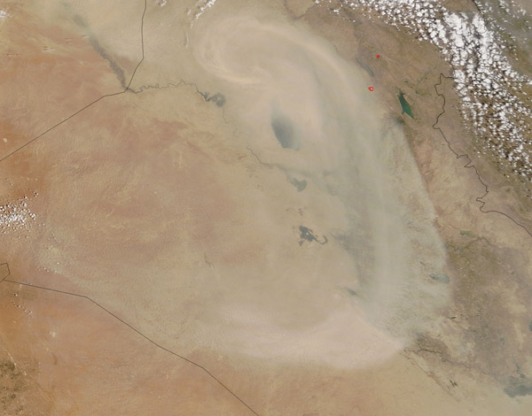
June 25, 2016 - Dust storm in Iraq
Tweet
Heavy winds across the Sahara Desert drove dust high into the atmosphere and carried it thousands of miles northeastward from its origins across Africa in mid-June 2016. A powerful jet stream along with cyclonic activity and a cold front over the southern Mediterranean pulled dust from the western Sahara Desert across southern Italy, the central Balkan Peninsula and into eastern Hungary by June 18, while the jet stream combined with turbulent air across the eastern Sahara region to deliver dust across the Red Sea and the Arabian Peninsula on that same day.
The Moderate Resolution Imaging Spectroradiometer (MODIS) aboard NASA's Aqua satellite captured this true-color image of Saharan dust swirling over Iraq on June 18, 2016.
The swirling sand follows the complicated wind pattern over Iraq, with the center of the swirl near the city of Tikrit, on the Tigris River and north of the long Thertar Lake. The dust is so thick that it obscures many features of the land from view, including the cities of Baghdad which lies under the thickest band of dust east of Thertar Lake.
Image Facts
Satellite:
Terra
Date Acquired: 6/18/2016
Resolutions:
1km (123.8 KB), 500m (382.9 KB), 250m (922.8 KB)
Bands Used: 1,4,3
Image Credit:
Jeff Schmaltz, MODIS Land Rapid Response Team, NASA GSFC


